Notes on a visit to Porcupine Gorge National Park
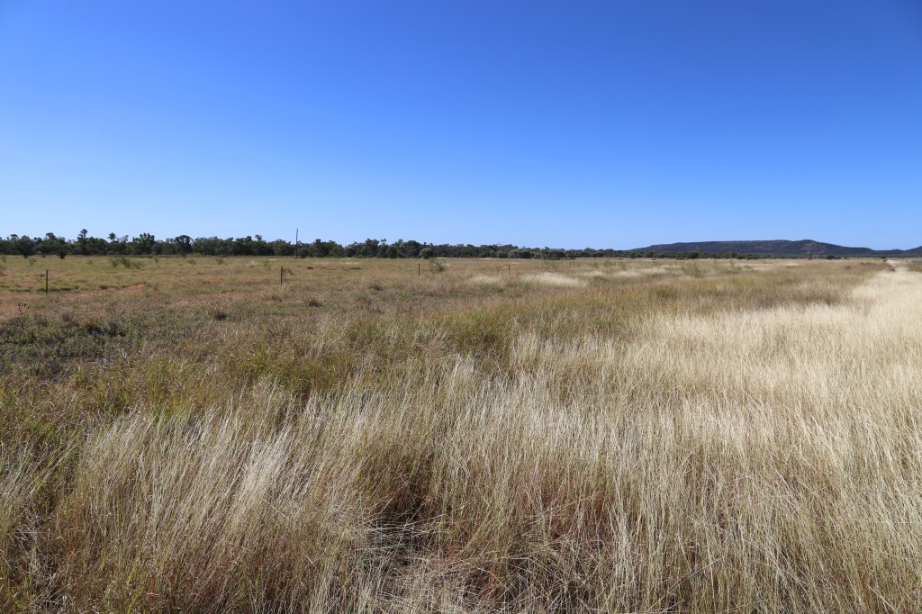
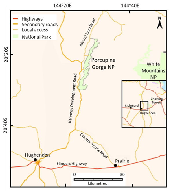
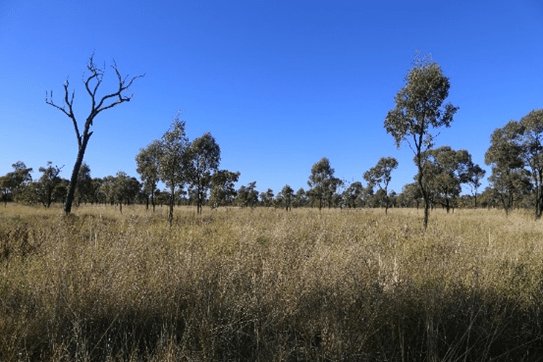
In Flinders Shire, North Queensland, between Hughenden and The Lynd, the Kennedy Development Road rises through plains of Mitchell grass (Astrebla spp), growing with mainly acacias on cracking black soils, into open Acacia and eucalypt woodlands on a plateau topped with basalt.
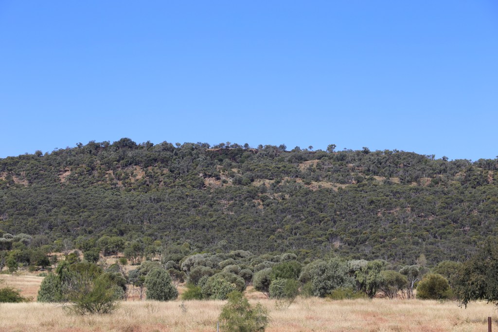
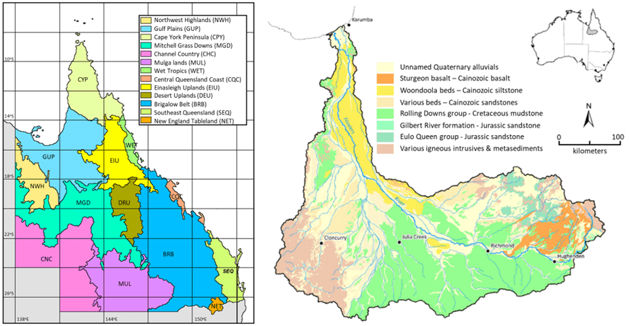
The plateau is part of the Sturgeon Volcanic Province, 7,500 km2 of lavas excreted from 40-50 volcanic centres mainly in the Pliocene and Pleistocene. The basalt rocks and flows overlay sedimentary rocks of the Carpentaria-Eromanga Basins. The most recent flow is dated at 0.92 Ma and travelled 120 km from its source at Twins Crater (Coventry et al 1985, Johnson et al 1989).
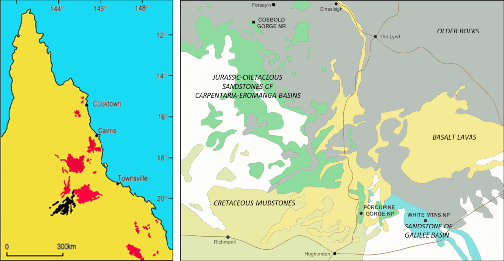
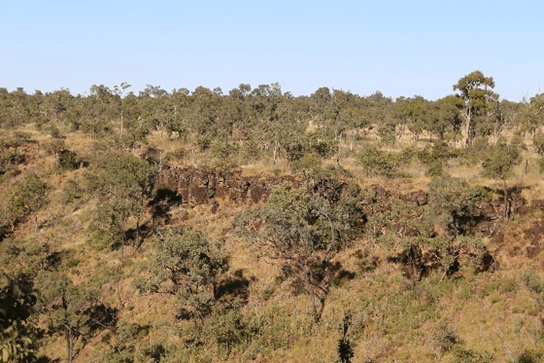
At Porcupine Gorge, Porcupine Creek (aka Galah Creek) has eroded through parts of the basalt cap, scouring and exposing underlying sandstones and metamorphics to ca 120 m.

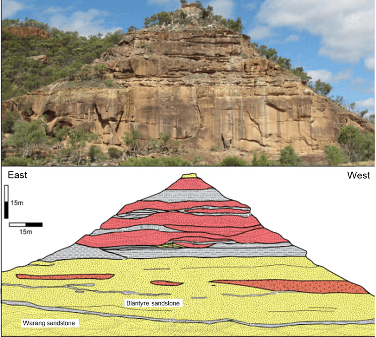
Image from Willmott et al, 2017.
Gazetted in 1970, added to in 1990, and administered by the Queensland Parks and Wildlife Service (QPWS) under the Nature Conservation Act 1992, Porcupine Gorge National Park encompasses 5,410 ha along ca 25 km of the middle and upper parts of the Gorge, plus open woodland and grassland on the surrounding plateau.
Click on images to enlarge. Images from Department of Environment and Science (DES) 2023.
The northern section of the park is in the Einasleigh Uplands Biogeographic Region and the southern section is in the Mitchell Grass Downs Biogeographic Region. The park is on the western edge of the 109,000 km2 catchment of the Flinders River. Originating in the Burra Range, 110 km NE of Hughenden, the longest river in Queensland flows 1,004 km into the Gulf of Carpentaria, 25 km west of Karumba. Porcupine Creek flows south into the Flinders River which turns subsequently to the west and then north.
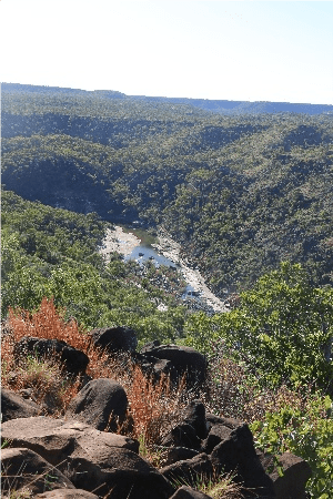
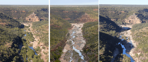
A look-out over Porcupine Gorge
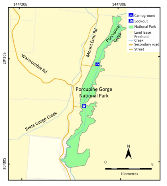
Circa 63 km north of Hughenden is a 2 km track to a lookout on the edge of the middle Gorge. The upstream (northerly) and downstream (southerly) views provide insight into processes that formed it, the strata it dissects, and the vegetation. At the base of the Gorge is the stream-gouged trough. Depending upon recent water flows the base may be lined with vegetation or scoured. The cliffs and scree host vine thicket, eucalypts and acacias.
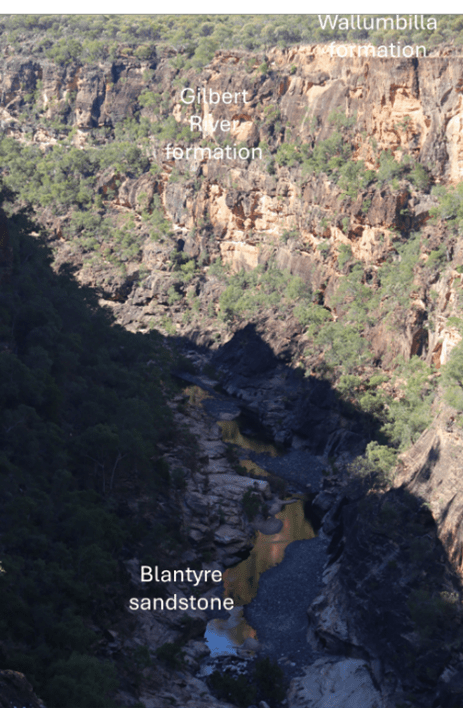
Geologically, Porcupine Gorge is relatively recent. The capping basalts range from 5.9 my to 0.89 my. In contrast, the strata uncovered by the erosion are up to 500 my. The latter include Permian glacial sediments and a section of Cambrian-Ordovician Cape River beds.
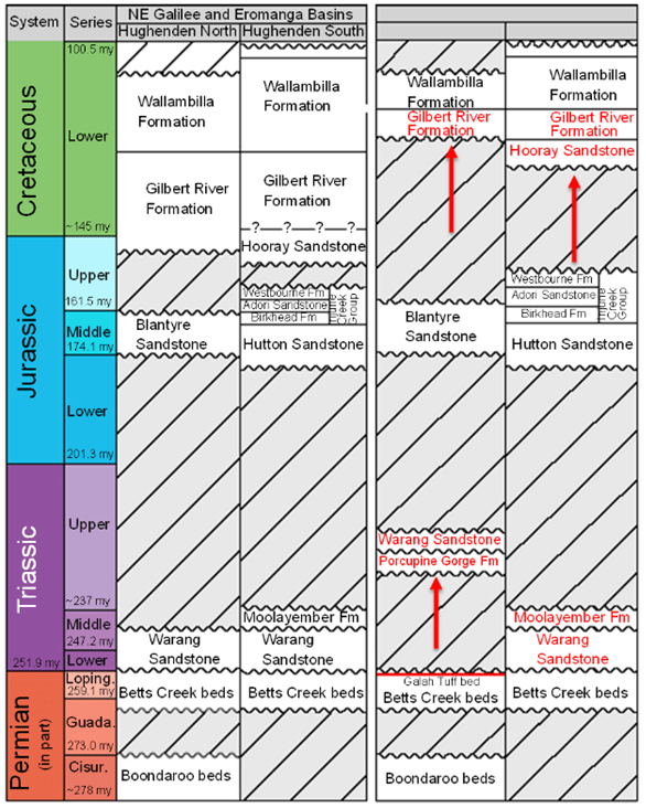
Grey-shaded boxes are periods that lack preservation in the Gorge or are of depositional hiatus
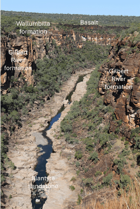
The black and orange-red tinted boulders visible on outcrops above the lookout are the youngest stratum, basalt that at most 5 my ago covered the surface and flooded low-lying indentations. Beneath this cap are the sedimentary layers. The lookout is on the uppermost layer, white calcareous siltstone of the Wallumbilla Formation, laid down in a shallow sea ca 120 to 110 my ago in the Cretaceous. Below the siltstone is the reddish and white-mottled sandstone of the Gilbert River Formation, deposited on river plains ca 150 to 120 mya in the late Jurassic to early Cretaceous. Below this, forming convex cliffs, is the dull-brown Blantyre Sandstone, deposited on river plains ca 170 my in the Jurassic. The junction between the Gilbert River and Blantyre sandstones slopes gently to the south. The stream bed hosts the erosion channel of the creek. Evident at all levels are the varied hues and textures of the vegetation types.
The Pyramid Camping Area
The Pyramid Camping Area turn-off is 11.7 km north of the Gorge Look-out. From the turn-off, follow the Mount Emu Road for 4.4 km, then turn east and follow the road for 2.4 km.
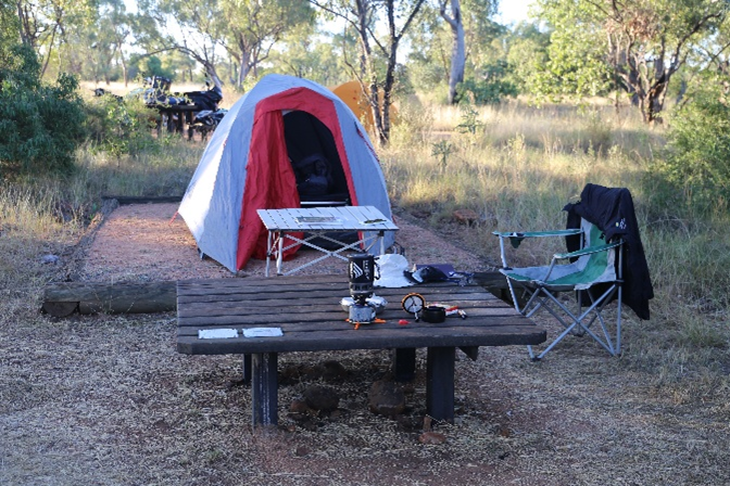
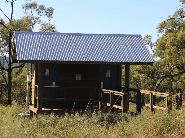
Book camping spots at the Pyramid Camping Area and vehicle access to the National Park in advance at https://parks.desi.qld.gov.au/parks/porcupine-gorge. There are 22 camping sites, two toilets blocks and covered picnic tables. Some sites have fire rings, the only places where fires are permitted. There are neither showers nor BBQs. During the dry season, there is competition for camping spots, so book early! Water is available but bring your own. The QPWS web-site warns that the quality and quantity of water is ‘unreliable’.
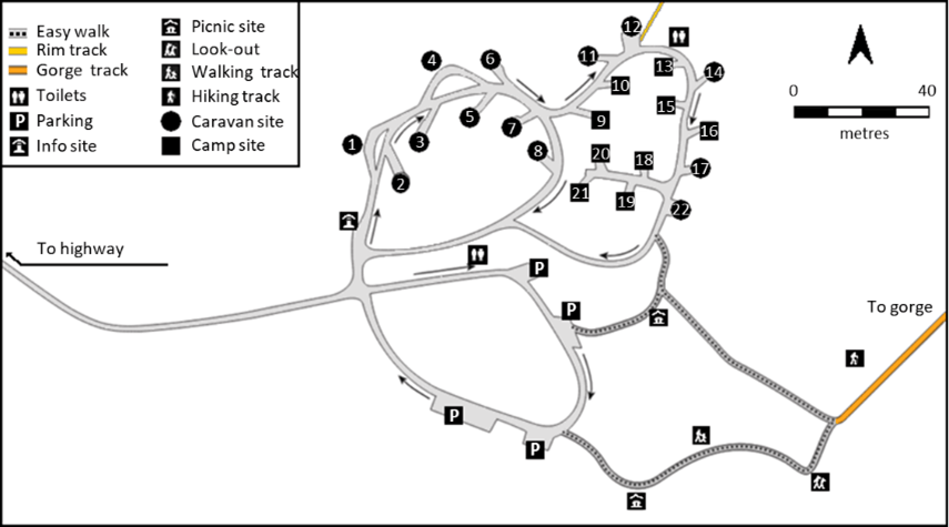
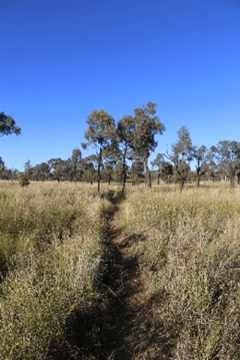
The camp-ground is the origin of a walk to the rim (2.4 km roundtrip, 1 h) and a Gorge-walk (2.6 km roundtrip, 1.5 h). The rim walk is level with a few sections scattered with small rocks. It starts near camp site 12, passes through open eucalypt and Acacia woodland, and leads to the Gorge edge with an excellent view of the Pyramid downstream.
The 1.5 km Gorge-walk is a harder slog. It descends ca 100 m to the base of the Gorge (cf Thomas 1994; Dungey and Whytlaw 2007; Stone 2016). There are many uneven steps. The return trip can be tiring depending upon your level of fitness…I guess I am unfit!


The walk to the base of the Gorge below the camp-ground
The Gorge walk descends through black basalt boulders and outcrops, and then comes onto a reddish, coarse, pebbly sandstone, which may be Blantyre sandstone that was weathered at the surface before being covered by the basalt (Willmott surmises that it could be a thin layer of the overlying Gilbert River Formation). Lower down, grey sandstone and some beds of conglomerate (consolidated gravel) are of the Blantyre Sandstone.
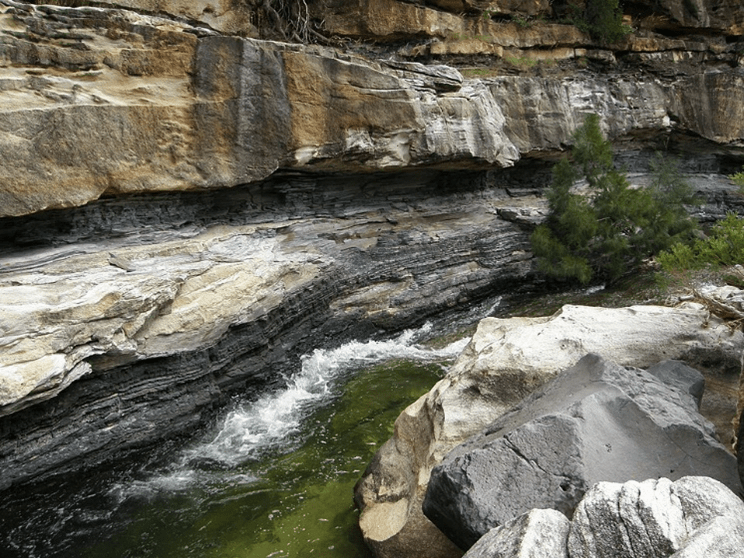
At the stream bed, the track emerges onto slabs of white Warang sandstone which was laid down by rivers ca 235 my in the mid-Triassic. Neither the Warang Sandstone, nor older strata, are seen at the surface further downstream in the Gorge (eg the look-out). In effect, a walk upstream (ie to the north) is a journey back in time (Willmott et al 2017).
The coarse, occasionally pebbly, white Warang sandstone has been sculpted by the stream. Cross-bedding can be seen in places. Downstream, the potholed pavement ends in sand-drift and pools at the foot of The Pyramid.


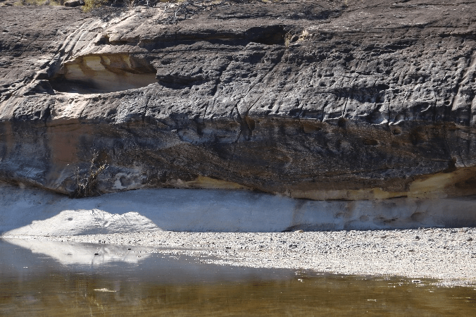
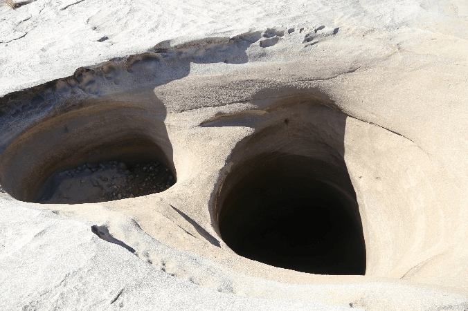
Bottom left: unconformity between Blantyre and underlying Warang sandstones. Bottom right: potholes scoured in the Warang sandstone.
Base of the Gorge upstream of the walking track
At the end of the walking track, the junction, or unconformity, between the Warang and overlying Blantyre Sandstone is visible in the bank opposite, sloping to the south. Downstream is the Pyramid, a spur of brown, flat-bedded Blantyre Sandstone that has been cut off by the gorge and a side-gully to form equally-inclined sides. Thin beds of reddish sandstone at its top may belong to the overlying Gilbert River Formation. The line where the Blantyre Sandstone lies on top of the Warang Sandstone is above the pool at the base of the Pyramid.
The landscape at the gorge bottom reflects water flows through the Gorge – the left image below was taken before the 2019 floods, the right image afterwards (Tattersall 2025)!
Left and middle photos from Tattersall (2025). Right photo: JAM Holtum.
According to Willmott et al (2017), upstream from the spot where the track enters the bottom of the Gorge, the Warang Sandstone is exposed in the stream bed and in cliffs on both sides for some kilometres. The Blantyre Sandstone thins out (probably eroded), until cliffs of black basalt high in the gorge walls lie directly upon the Warang Sandstone. The Warang Sandstone has a kaolinite clay matrix and patches of it have disintegrated through softening by groundwater and erosion by wind to create overhangs and shallow caves. Upstream, after a long bend to the right where blocks of sandstone have fallen, some beds of weathered siltstone and shale within the Warang Sandstone are visible in the cliffs. Erosion of these soft rocks has resulted in the collapse of the sandstone above.
Further upstream around a long bend to the left, the sandstone becomes coarser, with beds and patches of conglomerate, and there are also more beds of siltstone, shale and black carbonaceous shale. The older Permian Bett’s Creek beds and the Boondaroo beds, and the Cambrian-Ordovician Cape River Metamorphics (Charters Towers Precinct) become visible. The lower section of the Bett’s beds contains interbedded siltstone and mudstone with some sub-bituminous coal seams. Above these are larger mudstone beds that contain fossils of the Glossopteris flora (Whitehouse 1940), a Permian and Gondwanan indicator. The uppermost layers are sandstone with intermittent mudstone.
(Rands 1891 cited in Whitehouse 1940). Image: Wikimedia Commons.
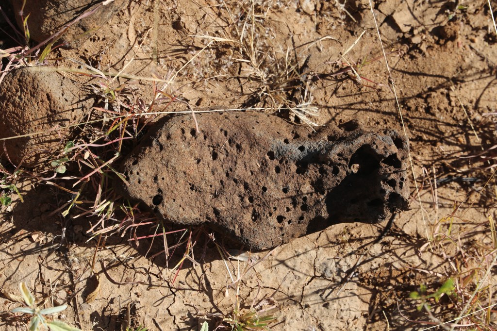
The upper Gorge is allegedly a tract of boulders and impassable pools. Cobbles of black, banded gneiss eroded from the metamorphics are common in the stream bed all the way down the Gorge.
More geological detail to come…possibly
The biology of Porcupine Gorge National Park
I am still trying to put together species lists as appendices and am looking for a good vegetation map – can’t get into the Qld site for some reason. It has very detailed vegetation maps.
References
Atlas of Living Australia. 2025. https://ala.org.au.
Coffey D, Grigorescu M, McKellar JL, Isles A. 2017. A review of the geology and exploration history of the Lopingian (late Permian) coals in the northern Galilee Basin. Queensland Minerals and Energy Review Series, Department of Natural Resources and Mines, Queensland
Coventry RJ, Stephenson PJ, Webb AW. 1985. Chronology of landscape evolution and soil development in the upper Flinders River area, Queensland, based on isotopic dating of Cainozoic basalts. Australian Journal of Earth Sciences, 32, 433–447. https://doi.org/10.1080/08120098508729342
Department of Environment and Science (DES). 2023. Porcupine Gorge Management Plan 2011. State of Queensland, Planning Services Unit. https://parks.des.qld.gov.au/data/assets/pdf_file/0024/168612/mp007-porcupine-gorge-np-mgtplan-gic-approved-2011
Dungey K, Whytlaw J. 2007. Tropical walking tracks of north Queensland. Footloose Publications.
Queensland Department of Environment, Tourism, Science and Innovation. 2025. https://parks.desi.qld.gov.au/parks/porcupine-gorge. Website as written on 22-05-2025.
iNaturalist.ca. 2025. Porcupine Gorge check list. https://inaturalist.ca/check_lists/155276-Porcupine-Gorge-Check-List
iNaturalist.ca. 2025. Flinders check list. https://inaturalist.ala.org.au/check_lists/21714-Flinders-Check-List
Johnson RW, Knutson J, Taylor SR (eds). 1989. Intraplate volcanism in eastern Australia and New Zealand. Cambridge, England: Cambridge Univ Press, 408 pp.
Stone D. 2016. Walks, Tracks and trails of Queensland’s tropics. CSIRO Publishing
Tattersall M. 2025. Green Path website. https://malcolmtattersall.com.au/wp/2019/07/porcupine-gorge-floods/
Thomas T T. 1994. 50 walks in North Queensland. Hill of Content, Melbourne.
Tindale MD, Roux DG. 1974. An extended phytochemical survey of Australian species of Acacia: chemotaxonomic and phylogenetic aspects Phytochemistry 13: 829-839
Todd CN. 2020. The sedimentary evolution of Permian to Cretaceous basins in Queensland, Australia: insights from lithostratigraphy, U–Pb zircon geochronology, sedimentary facies, and provenance analysis. PhD Thesis, James Cook University.
Whitehouse FW. 1940. Studies in the history of late geological Queensland. University of Queensland Papers, Department of Geology, Volume 2 (New Series) number 1: 1-74.
Willmott W. 2009. Rocks and Landscapes of the National Parks of North Queensland. Geological Society of Australia, Queensland Division.
Willmott W, Cook A, Neville B. 2017. Rocks, landscapes and resources of the great Artesian Basin. A handbook for travellers. Geological Society of Australia, Queensland Division.
World Wide Wattle. 2025. https://worldwidewattle.com. Website as written on 22-05-2025.
