BOOGIE TO Boodjamulla
This jaunt to Boodjamulla National Park (Lawn Hill) on Mumbaleeya country in western Queensland involved
- assisting Simon Robson with a TERN-funded bat-monitoring study
- removing rubber-vine (Cryptostega grandiflora) from banks of the Gregory River
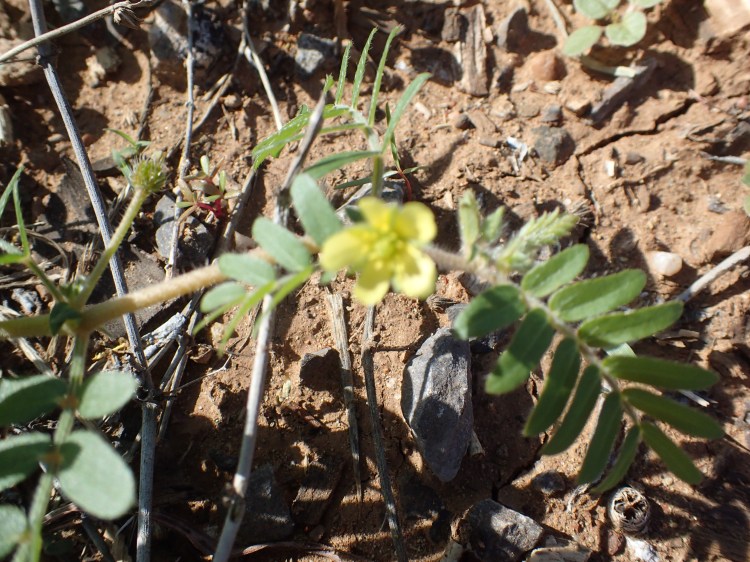
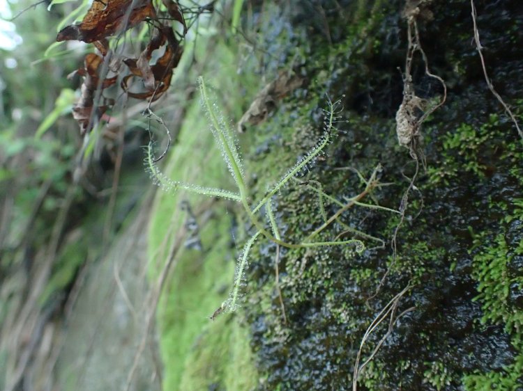
- collecting Tribulopis, Tribulus and Portulaca
- visiting the Riversleigh World Heritage fossil site
- investigating the Nowranie caves near Camooweal
The trip
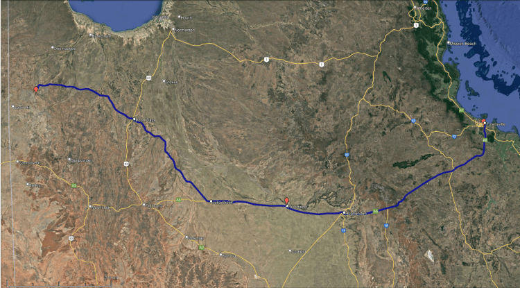
Townsville to Richmond (20/05/22): stopped at the Burra Range (White Mountains NP), the point in the Great Dividing Range where water flows in three directions – into the inland rivers and Great Artesian aquifers to the west, to the coast in the east, and towards the landscapes in the north.
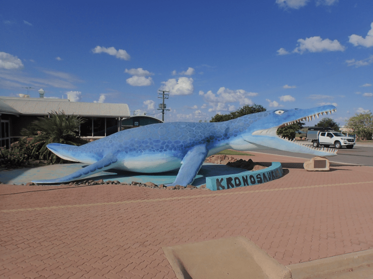
In Richmond we stayed at the Royal Palace Hotel
…and visited the local fossil museum, Kronosuarus Corner, which contains a spectacular marine fossile from the area. The kronosaurus is named after the Greek Titan, Kronos who, after a prophecy, feared he would be overthrown by one of his children, and so ate each one upon their birth.

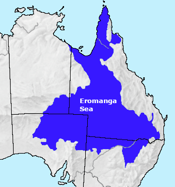
During the Cretaceous (ca. 100 Mya) Richmond was beneath several iterations of the Eromanga Sea, which extended from the Gulf of Carpentaria across much of what is now inland Queensland. The ancient sea-bed, upon which Hughenden, Richmond and Julia Creek sit, and from which the fossils are extracted, now hosts the vast Mitchell Plains Astrebla grasslands…and a few too many exotic prickly acacia (Acacia nilotica).
From Richmond (21/05/22): we followed the Flinders Highway and the Wills Developmental Road to Boodjamulla, passing by Julia Creek, the Burke and Wills Roadhouse and Gregory Springs. The grassy plains gave way to open woodlands. This was the last of the Portulaca we saw. We never found a Tribulopis.


Boodjamulla is a beautiful National Park that sits within a 1.5 billion year-old Proterozoic sandstone outcrop of the Lawn Hill Platform, a part of the Mt Isa Inlier.


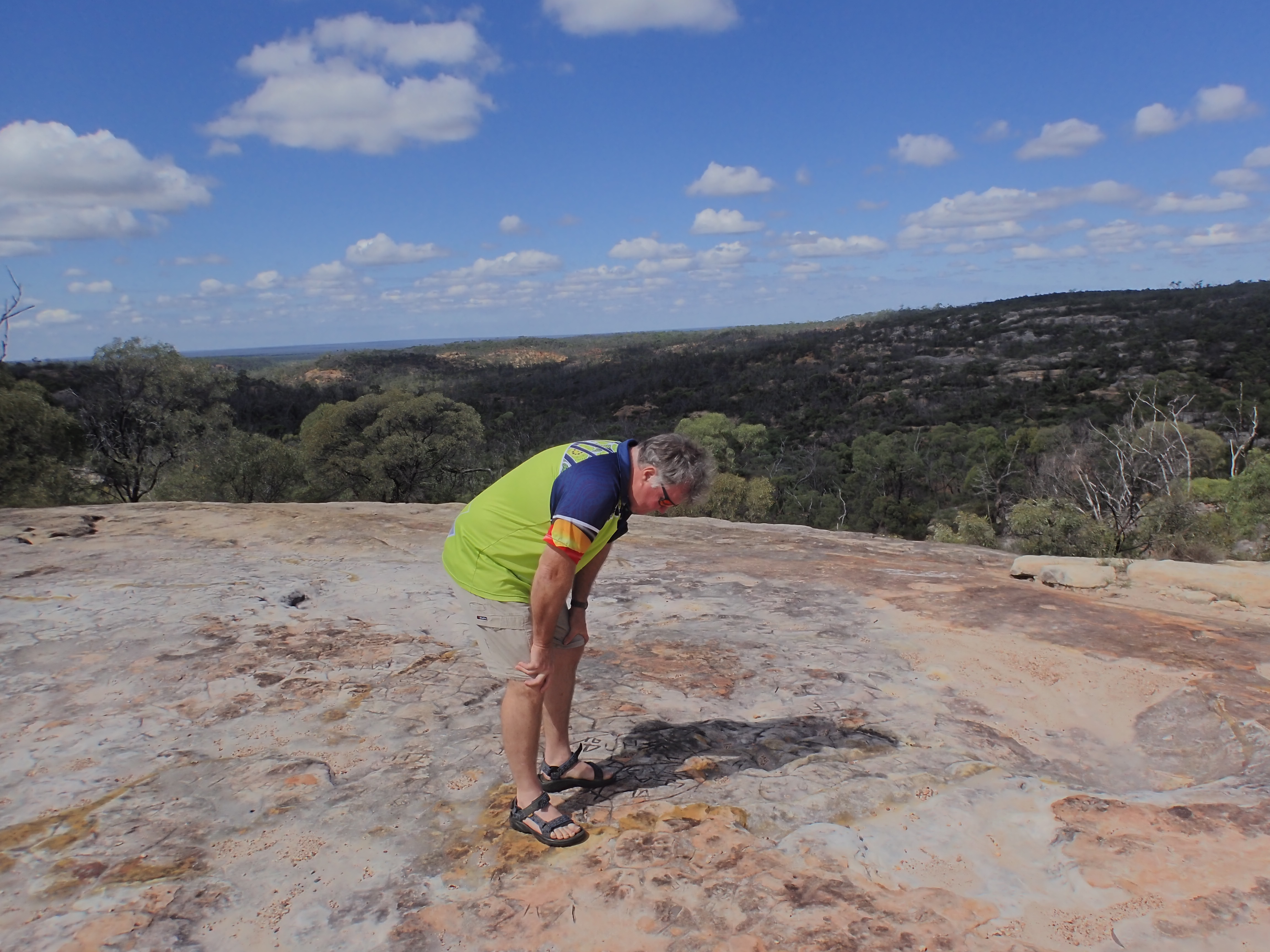
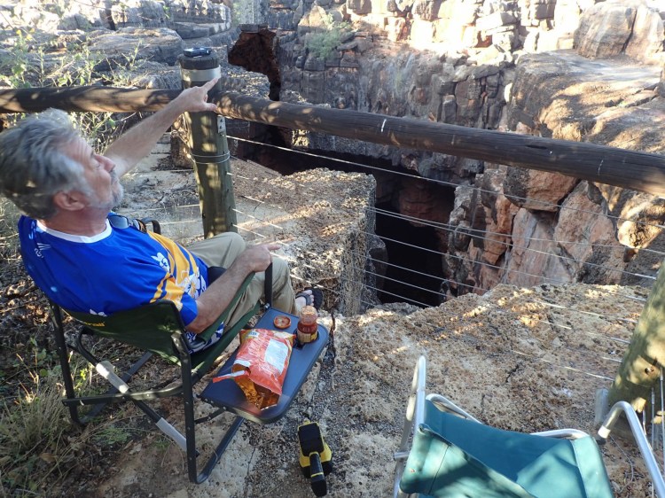
Right: tracks and lookouts at Boodjamulla National Park. Click on images to enlarge
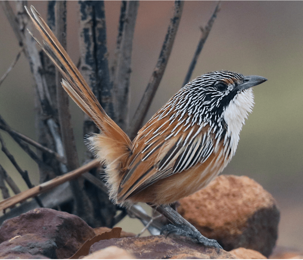
In the evening we socialized with Tablelands birders searching for the elusive Carpenteria grass wren (Amytornis dorotheae).
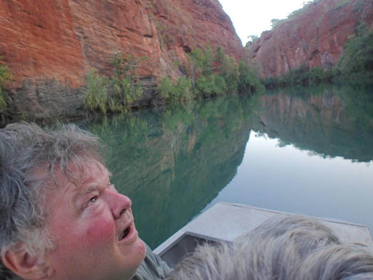
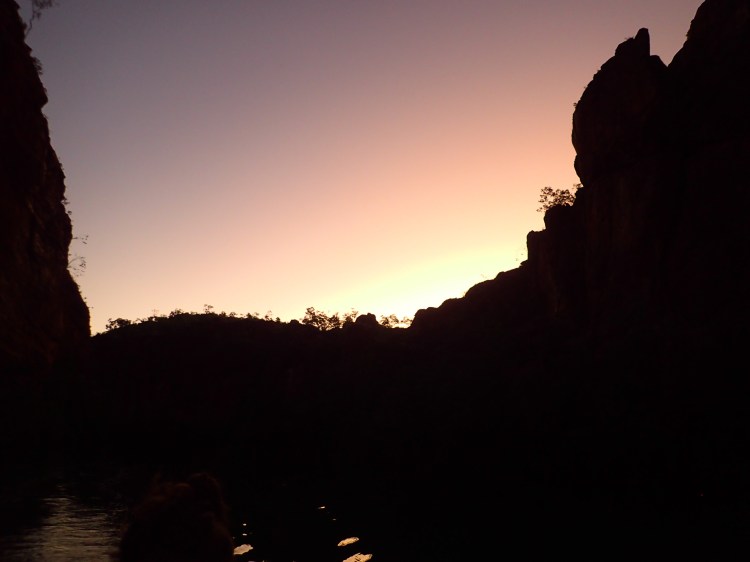
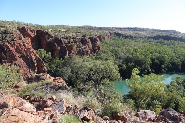
22/05/22: Simon hung a bat-detector on Indarri Lookout and I walked across the spinifex-covered (Triodia pungens) rocky outcrops bordering the Middle Gorge to Indarri Falls.
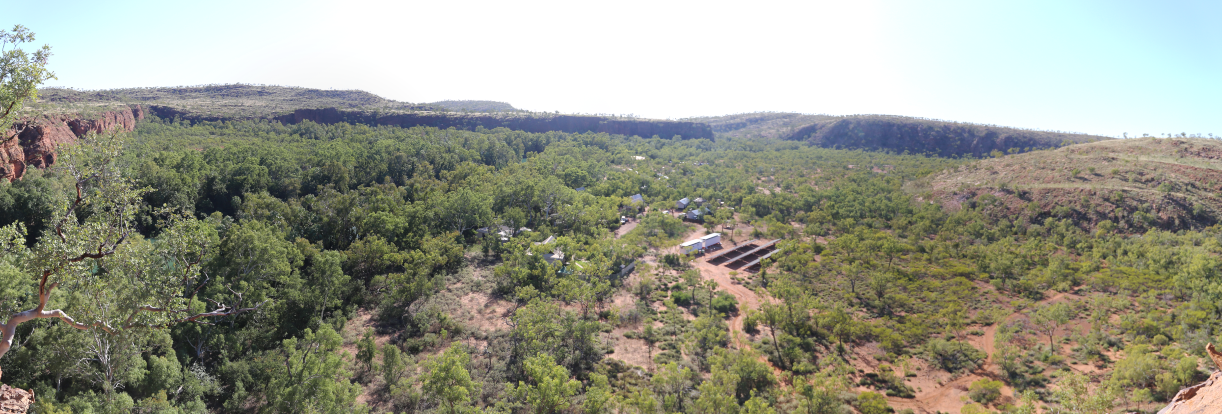
Camp-ground and Constance Ranges from Indarri Lookout 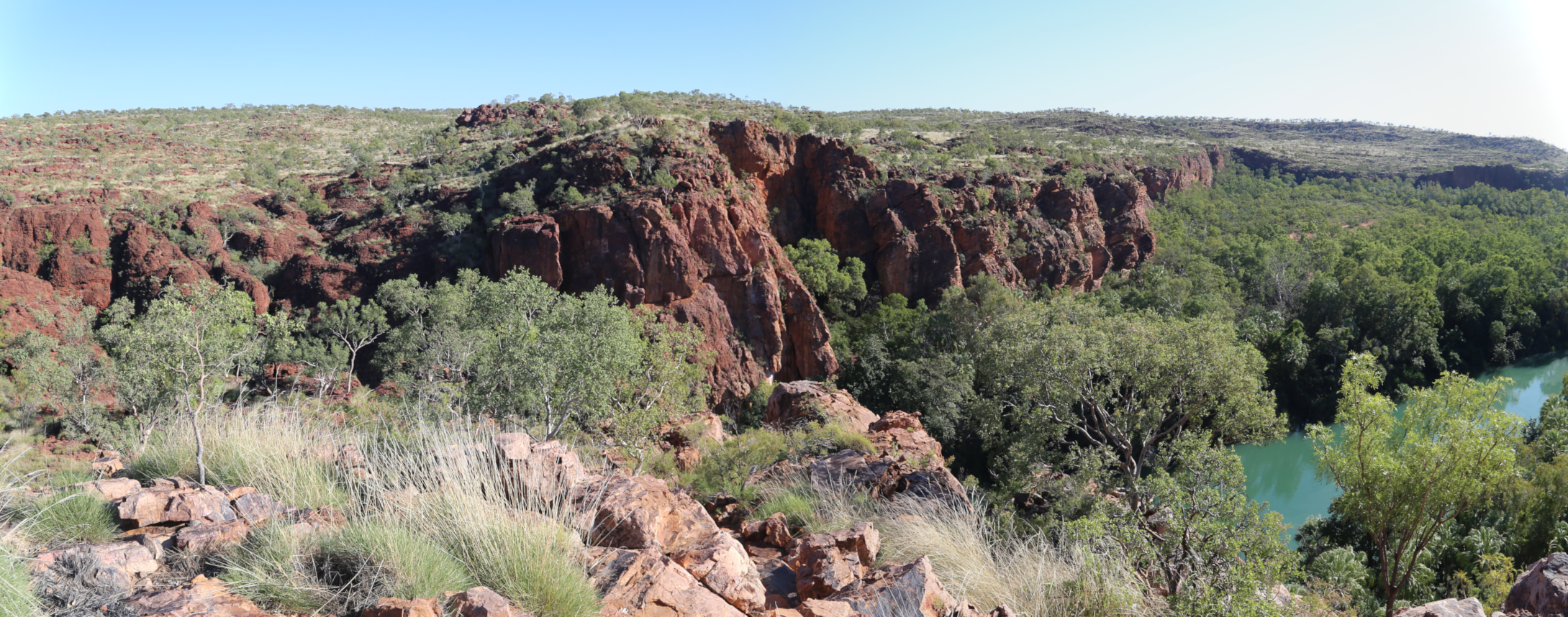
Middle gorge and Proterozoic sandstone from Indarri Lookout 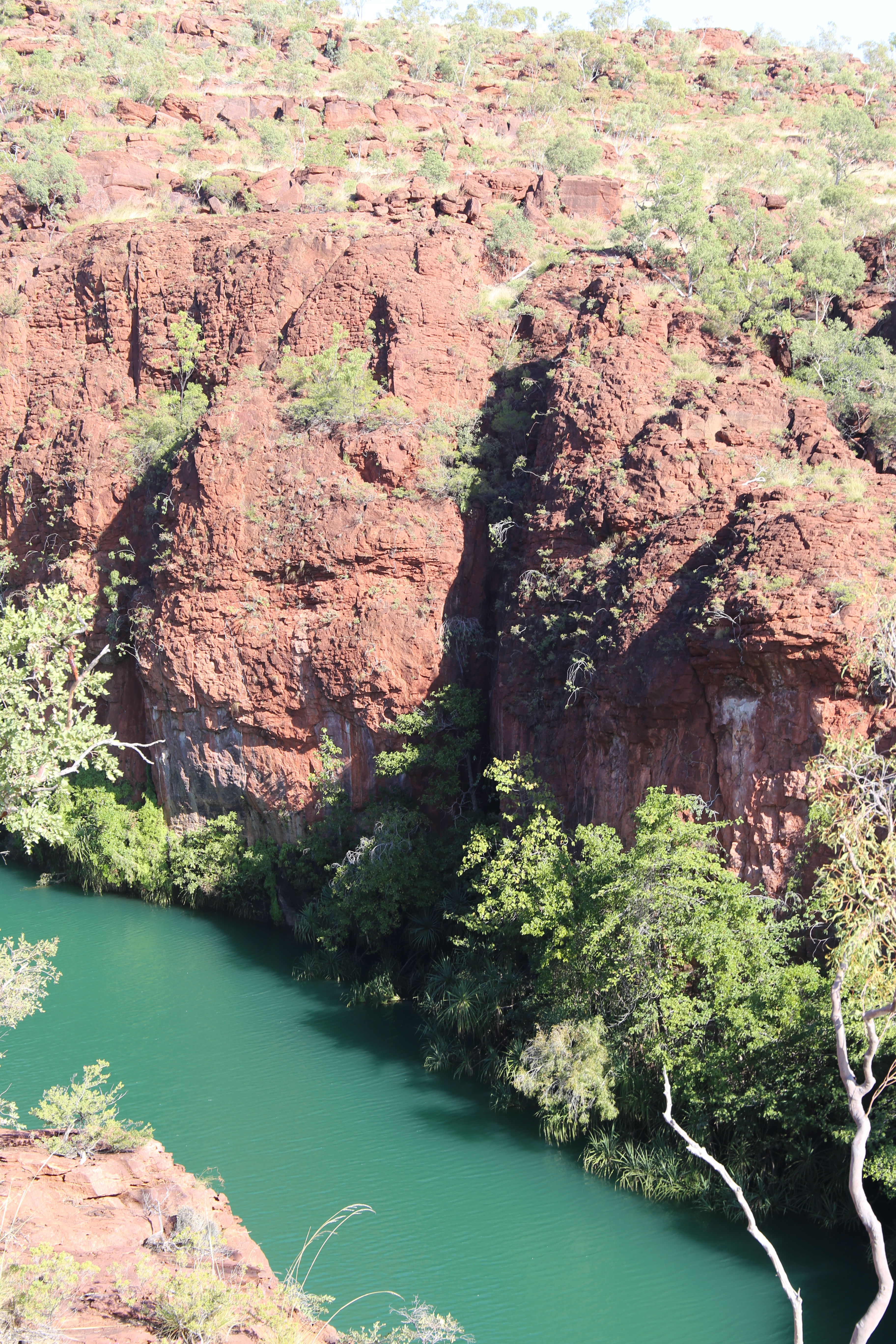
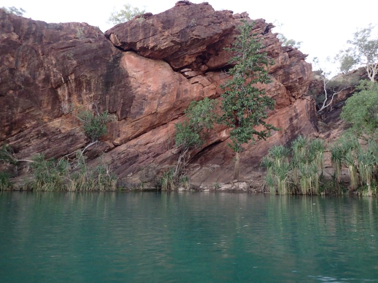
Middle Gorge and its green limestone fed waters 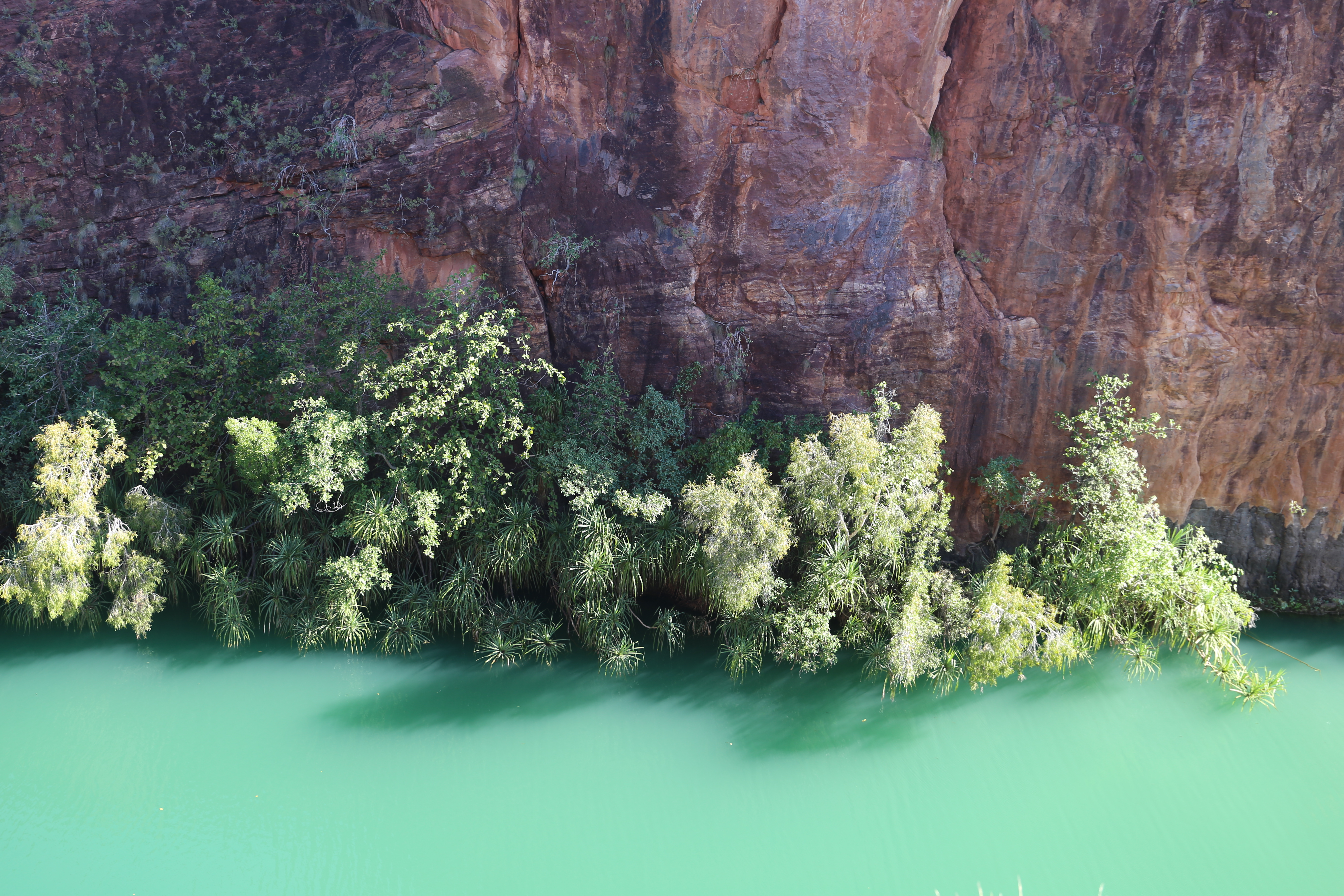
Trees lining thin slice of earth in Middle Gorge. Palms are Livistonia sp. 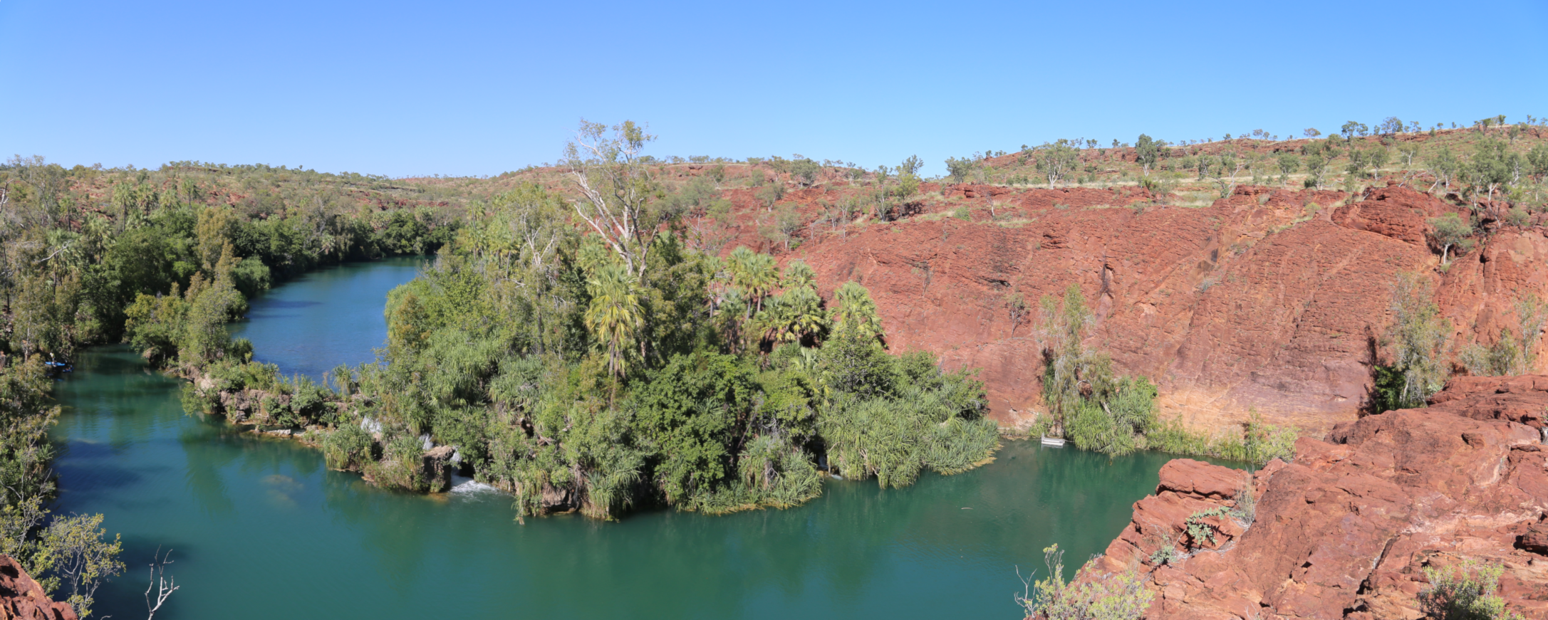
Indarri Falls. Crocodile trap to right 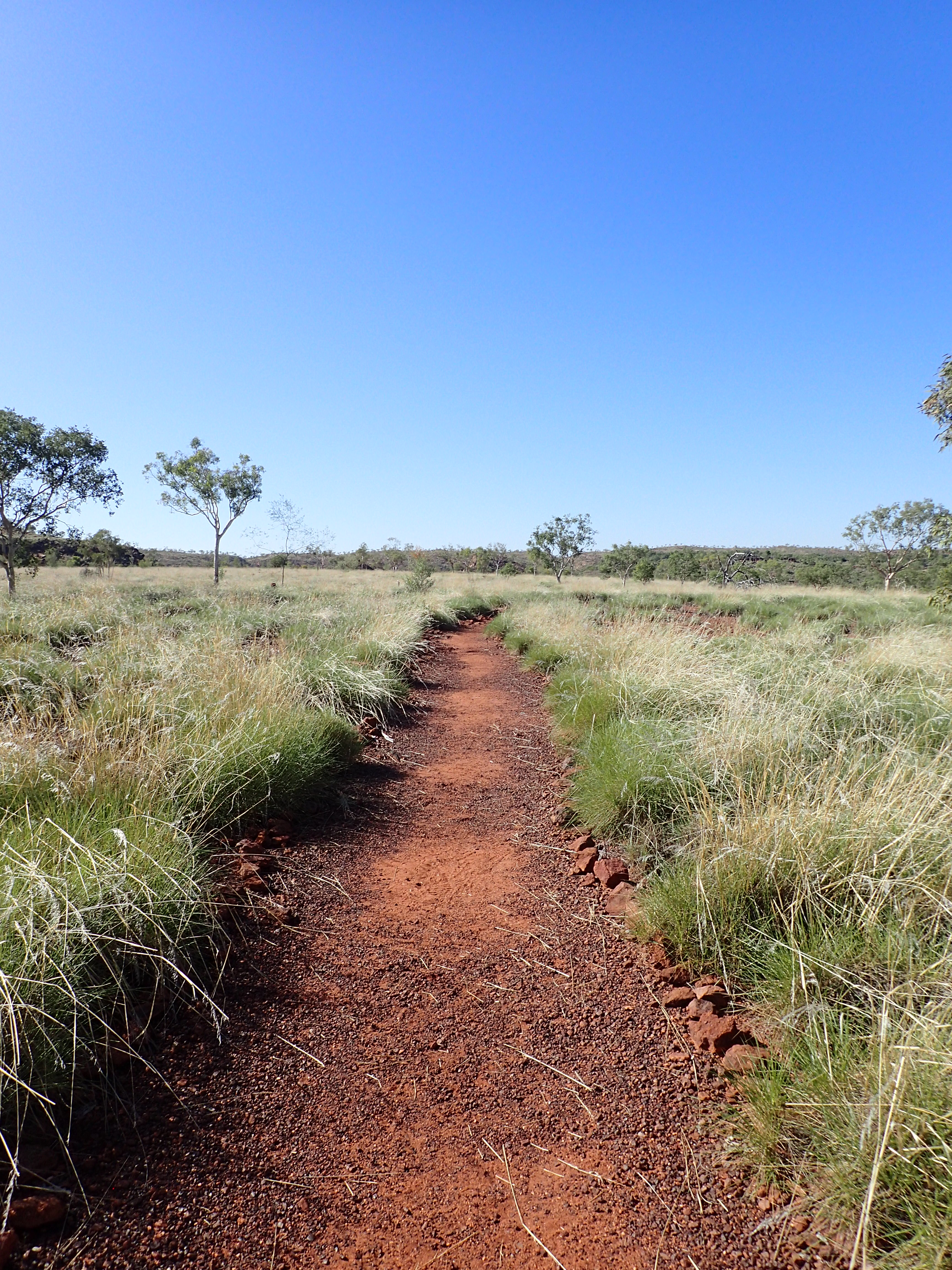
Path through the spinifex (Triodia pungens) 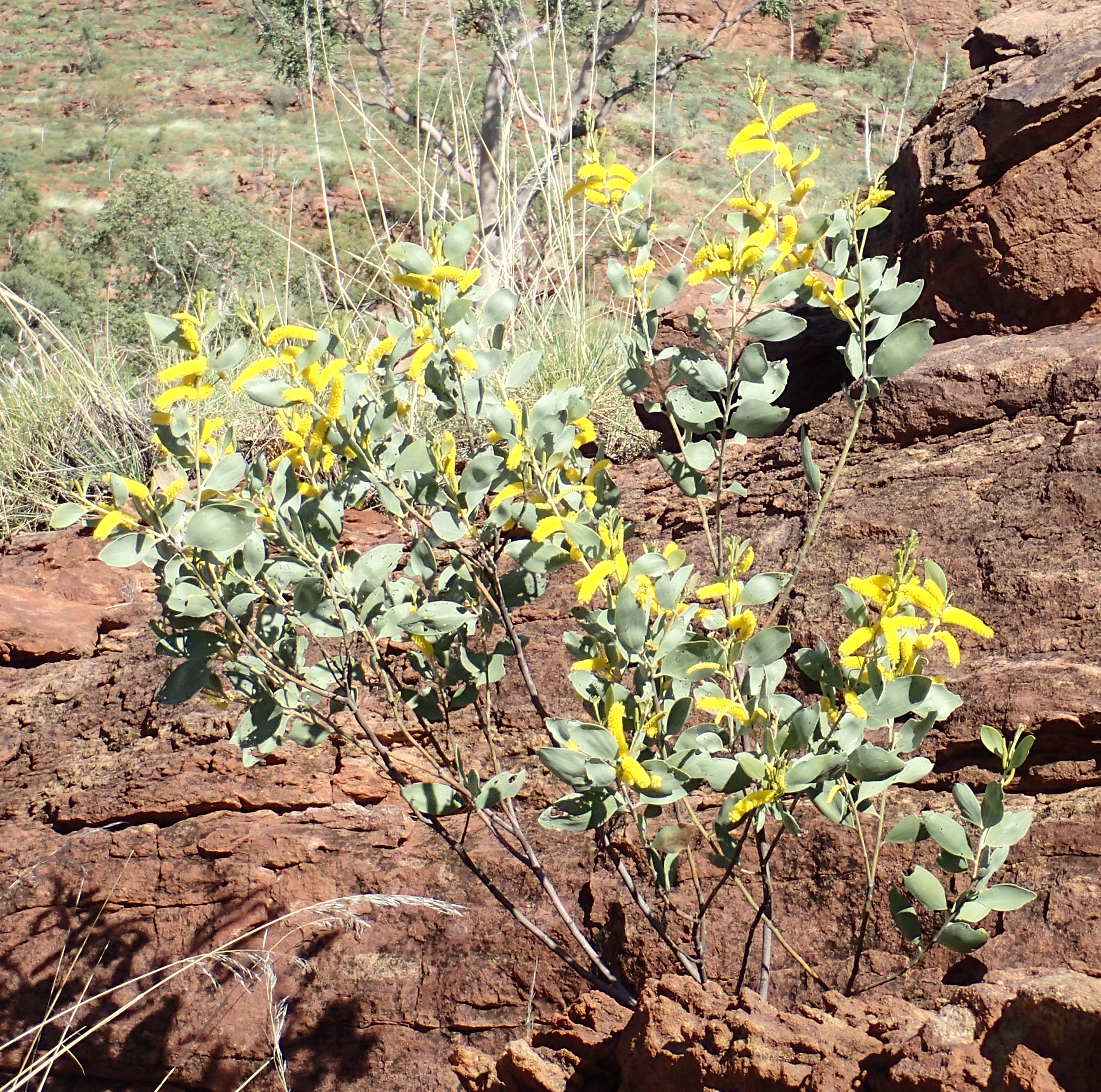
A pretty wattle
Invigorated by a swim, I walked alongside the creek on an unsuccessful plant hunt. Bat detecting at night by the creek was followed by discussions with a Chillago caving group who were exploring and discovering caves in the limestone karst to the north of the Upper Gorge of Lawn Hill Creek.
Celebrated the fall of the truly odious Morrison government!
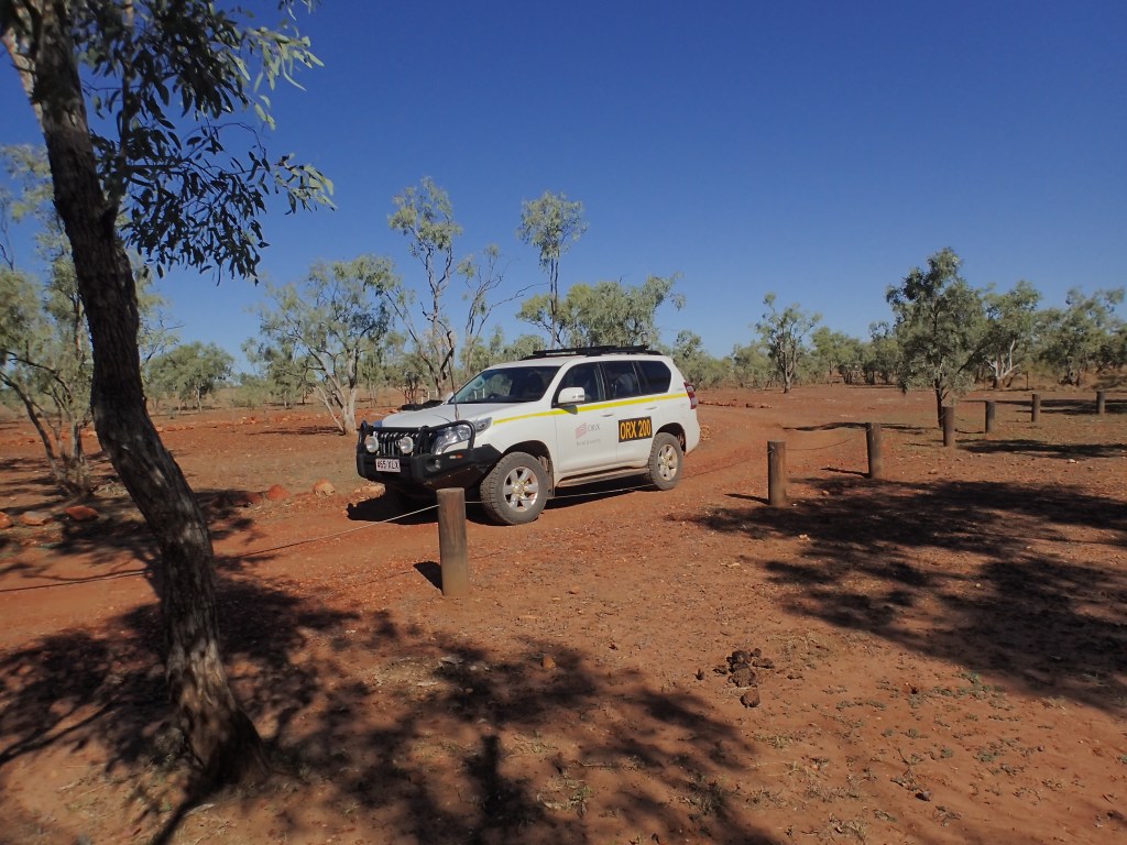
23/05/22: Serviced the bat-detector on the lookout and drove to Riversleigh, a UNESCO World Heritage site that Simon and I had wanted to visit for years. For such an internationally important biological site it is very low-key as a tourist spot – a parking area, small interpretive room and a looped path (photos towards bottom of page). There is an interpretive centre at Mt Isa.
24/05/22: As we flew to sink-hole at the park’s south, a potential ghost-bat site, I saw for the first time the exposed extensive jointed limestone beds of the region. We hung bat detectors at the site, at two unrecorded sink-holes and outside Gregory Cave.

The Cloncurry Mustering Company Robinson 44 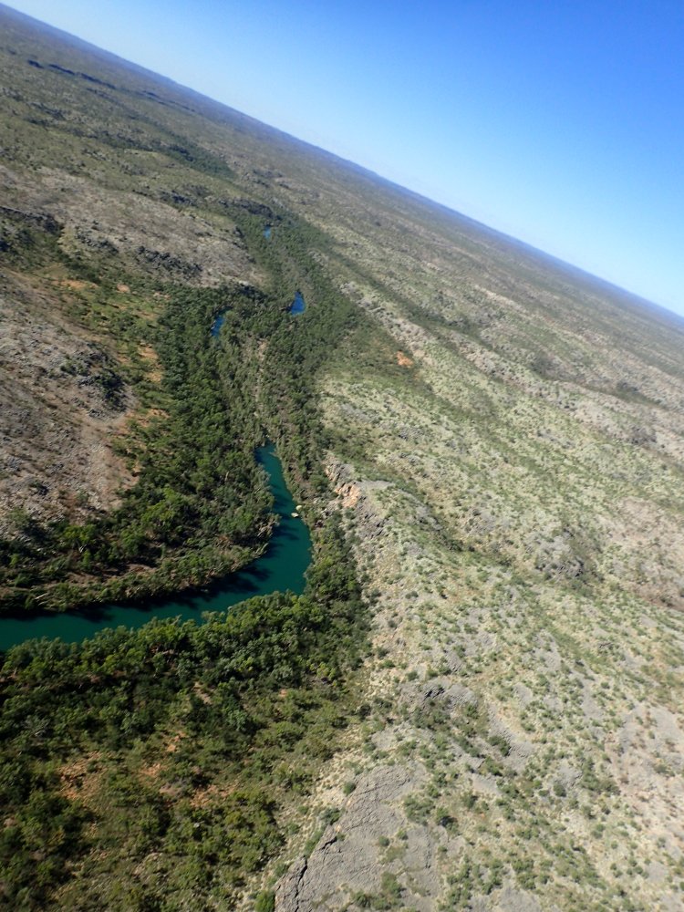
The riparian effect is not wide! 
Note the flattened trees along the river bank (where we cut rubber-vine) 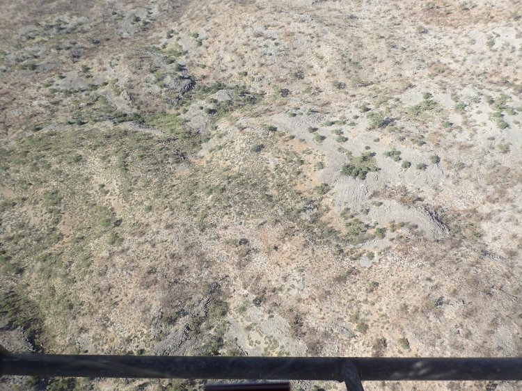
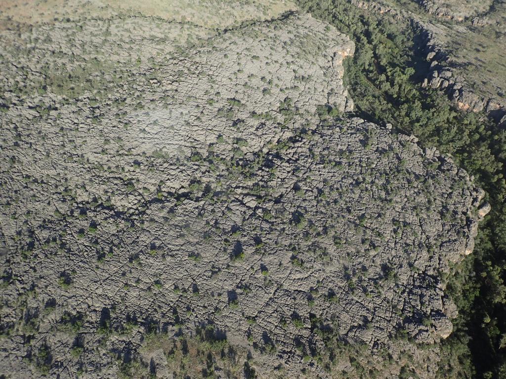
Landscape with limestone outcrops and vegetation burned in a mosaic (note spinifex clumps of different sizes i.e. age) 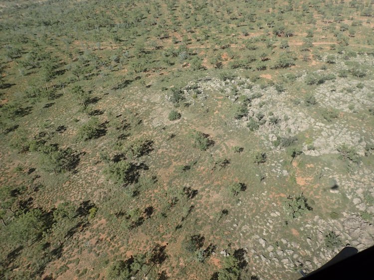
Landscape with limestone outcrops and vegetation burned in a mosaic (note spinifex clumps of different sizes i.e. age) 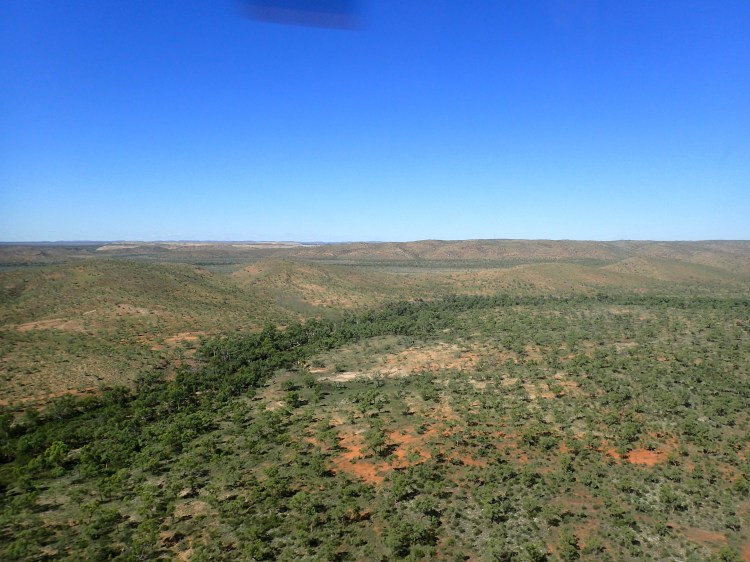
The pilot said that the circular feature was an ancient meteorite scar 
Lea Ezzy (QPWS) exploring an unrecorded sink-hole near the southern border of Boodjamulla 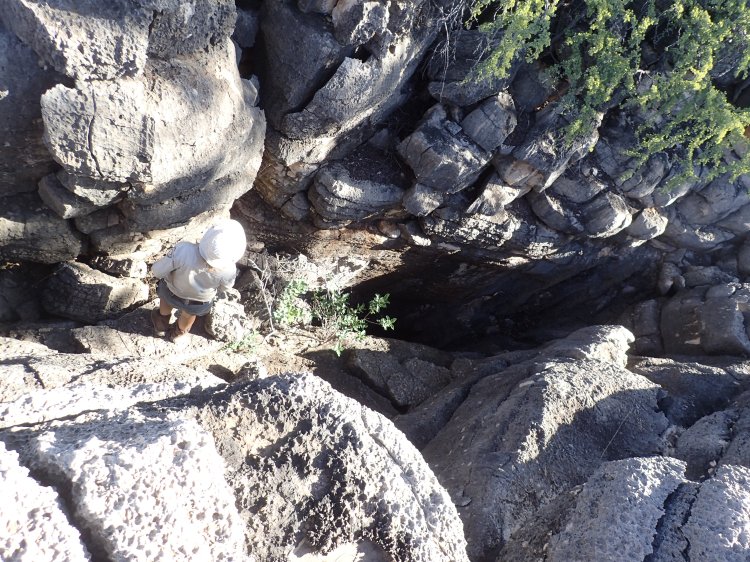
Another unredorded sink-hole. Notice the jointed fracturing 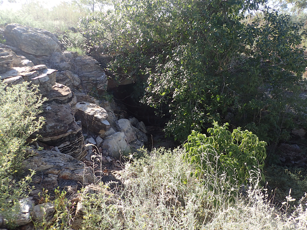
The mouth of Gregory Cave 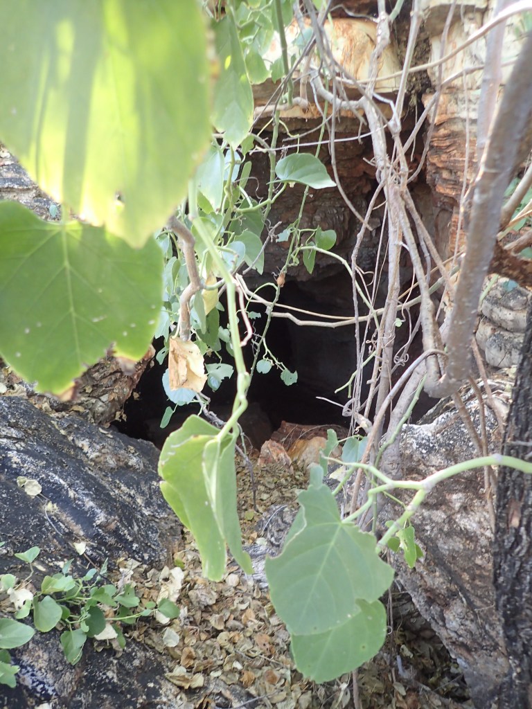
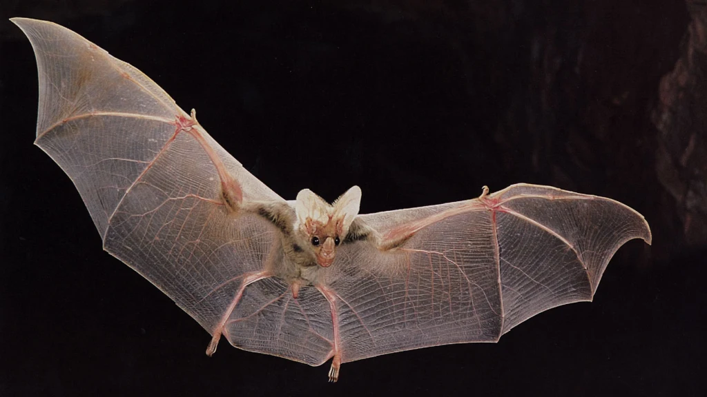
Gregory Cave mouth – artistic photo. Bat detectors outside detected orange horshoe bats (Rhinonicteris aurantia) but not ghost bats (Macroderma gigas)
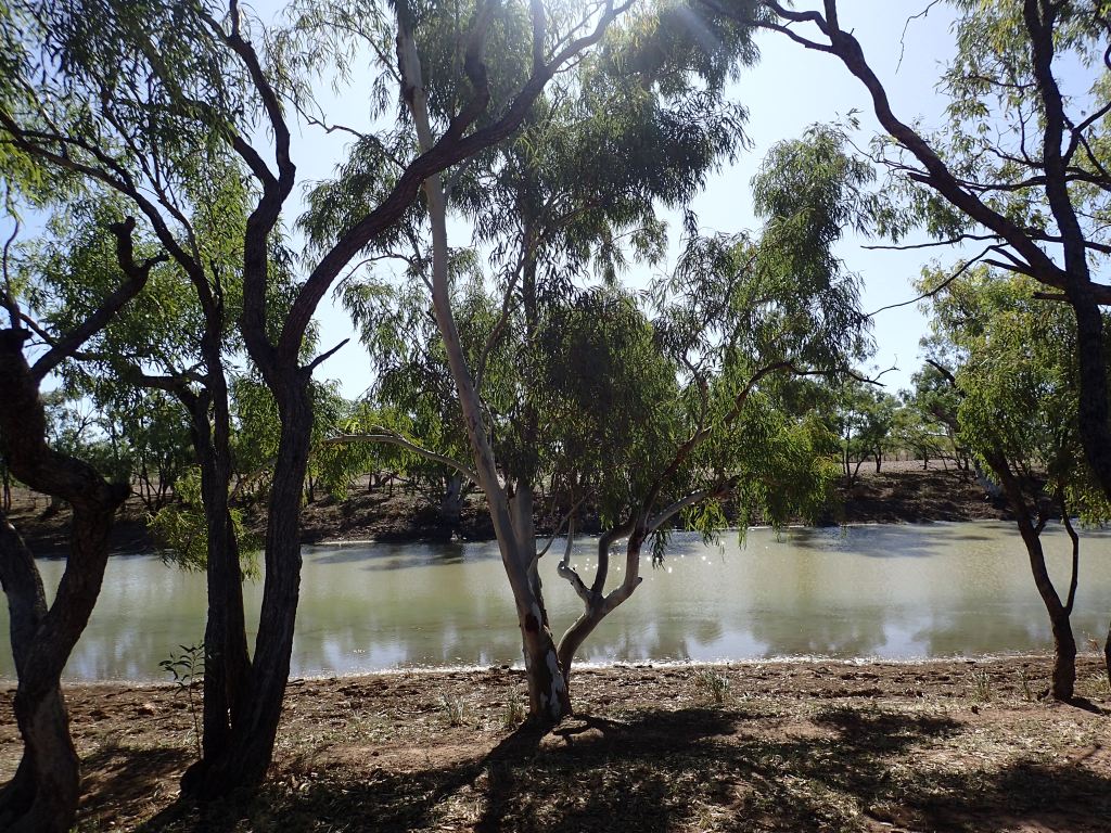
25/05/22: Flew to the Gregory River where we cut and poisoned rubber-vine in the riparian strip, a tangled mass of flood detritus: fallen river gums, melaleucas and palms. Must have been an enormous flood around Christmas. Didn’t see any Tribulopis, Tribulus or Portulaca. Checked out a couple of sink-holes that Davin, the chopper pilot, had noticed earlier – no bat smell noticed. Named them Lea’s Hole and Pilot’s Point.
After finishing off the gin we had a pleasant BBQ with local rangers Gaff and John, the shooter Shane (ranger at Bladensberg), Davin, and plant pathologists Louise and Alistair. Sad news from a potential ghost-bat site in NT – there is a covid outbreak and we cannot enter.
25/05/22: Lea and Simon on rubber-vine cutting and bat detector duties. I walked to within 1 km of Upper Gorge lookout but no Tribulopis, Tribulus or Portulaca, although other small forbs were flowering. Simon detected orange horseshoe bats outside Gregory Cave. An idyllic dusk punt up Lawn Hill Creek to the Indarri Falls was followed by a BBQ côtes de pork avec sumac a la Gaff.


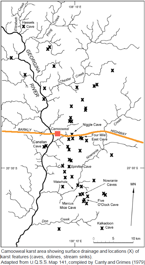
Wiliyan-ngurru National Park (Camooweal Caves NP) The Wiliyan-ngurru National Park is 15 km south of Camooweal (ca 249 km from Boodjamulla). A 1970s aerial study of the Tableland revealed 80 definite and 67 possible sinkholes, mostly in the Camooweal area.

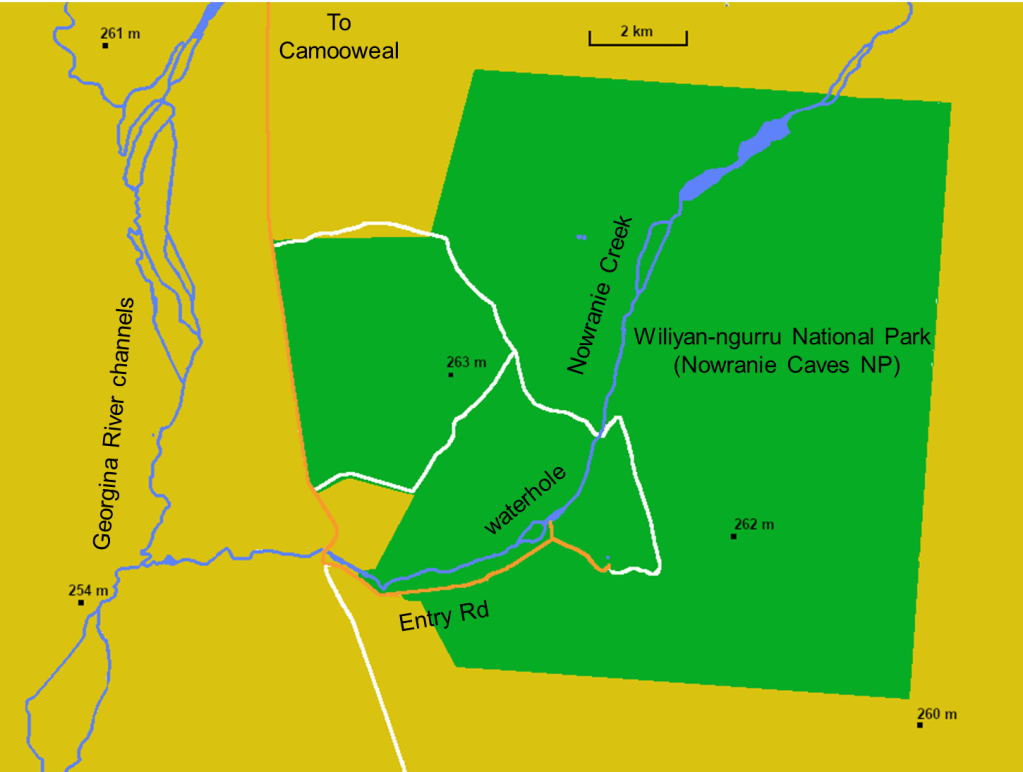
Set up bat detectors at the Small- and Large- Nowranie caves (see Ebehard 2003). A pair of Nankeen kestrels (Falco cenchroides) staked out the mouth of Large-Nowranie cave prior to dusk. Saw a ghost-bat (Macroderma gigas) and recorded a few calls. Ghost bats are Australia’s only mammal-eating carnivorous bat (and one of only two endemic bat genera). Seems to be disappearing in Queensland. Unsure whether this is cane toad related or he product of landscape opening.

At Nowranie, caves and sinkholes are in dolomite formed ca. 550 Mya (Cambrian) when calcium-magnesium carbonate precipitated from the shallow sea that formed the substrate of the Barkly Tableland. Water percolated through the fractures and bedding planes dissolving rock and creating caves. In places these are connected by vertical shafts.
Large Nowranie Cave: waiting for dusk with corn chips, salsa, camera and spotlight. 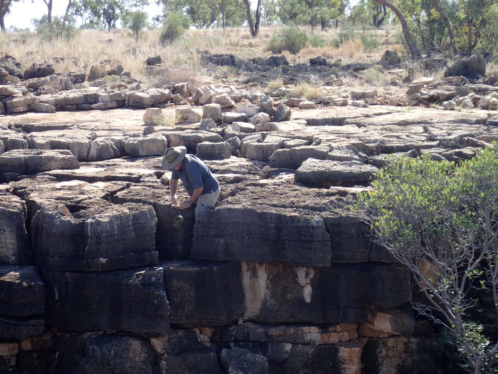
Professor Robson negotiating the jointed limestone karst bedding to safely deploy a bat-detector above Great Nowranie Cave 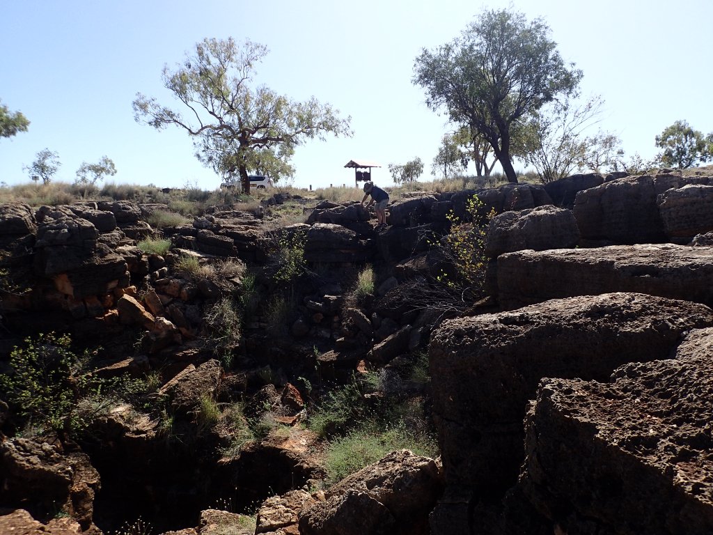
Small Nowranie is an easier climb for the nimble Professor Robson. Professor Holtum is a mere observer 
Small Nowranie Cave: it’s in the gloom of the eroded limestone joint
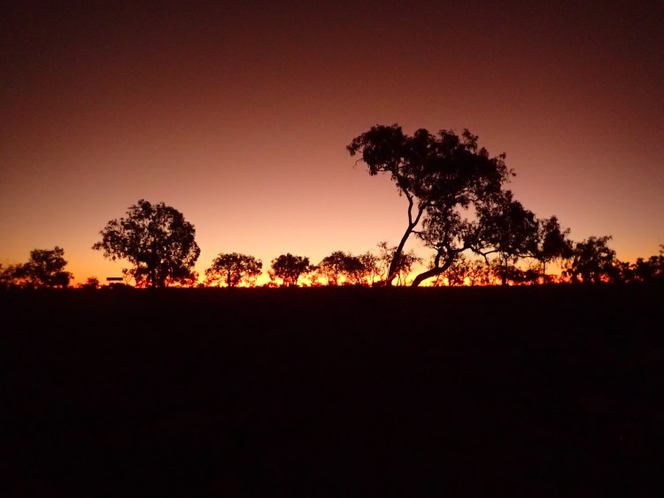
The Camooweal Post-Office Hotel was rocking! The annual Camooweal Rodeo started the next morning…the local lads and lassies were catching up with each other and a lot of rum was being sunk! Old fogies that we are, we snuck off and slept in the open at Nowranie Waterhole…a few mozzies but a wonderful red sunset and a Milky Way-dominated night sky.
A Brief Geology of Boodjamulla Boodjamulla is in an old landscape. It inhabits the Proterozoic Mount Isa Inlier (ca. 1,800 Mya) of the North Australian craton (craton = an ancient stable piece of the continent). Rocks of the Inlier outcrop in a typically 100 km-wide band that extends from the NT border to Mt Isa – Cloncurry. To the W and SW of the Inlier is the Georgina Basin which contains mainly sandstones, limestones and shales of Cambrian – Ordovician age (620-480 Mya).
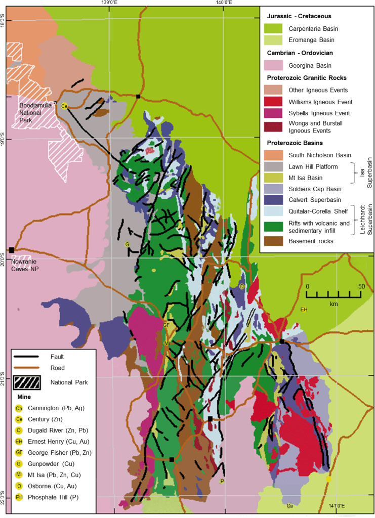
Within the Inlier, Boodjamulla lies in the Constance Range which is being eroded westward by the headwaters of streams that drain into the Gulf of Carpentaria. Technically speaking, the Boodjamulla gorges are eroding fractures in the late- Proterozoic Constance Range Sandstone (ca. 1,560 Mya), a gently-dipping hard-red orthoquartzite sandstone (Stevens 1984). The sandstone is unconformably overlain by middle-Cambrian Thorntonia Limestone (ca. 530 Mya) which precipitated from a shallow sea that lapped the old sandstone hills from the south and west. The grey limestones, which contain chert (silica), occur in upper parts of Boodjamulla Gorge and west of Riversleigh. Large grikefields occur in the limestones along the northern side of Colless Creek (grikes are clefts that form when rocks are dissolved by water along joints, a great word!).
Note added in 2023: the riparian zone shown below is essentially gone! Scoured out by floods.
Riversleigh In Boodjamulla’s south-east are fossils that provide evidence of the evolution and distribution of mammals, birds, reptiles and plants across ancient Australia after it separated from Gondwana, moved north, and dried (Archer et al 1994). Added to the UNESCO World Heritage List in 1994, Riversleigh contains limestones deposited between 25 and 15 Mya (late-Oligocene to mid-Miocene). Lying atop trilobite-containing Cambrian limestones that formed in a shallow marine sea ca. 530 Mya, the younger limestone was deposited in small rainforest lakes containing high levels of calcium carbonate.

Riversleigh Site D (11.61 to 5.33 Mya): a fossiliferous Late or Upper Miocene limestone outcrop 
Nests of either tree martins (Petrochelidon nigricans) or fairy martins (P. aerial) in the pretty basic ‘visitor centre’ 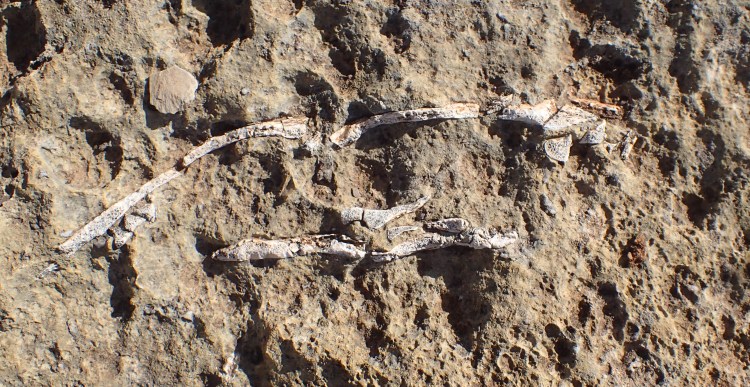
Fossil turtle in limestone matrix 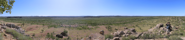
Landscape, interpretive centre and parking area from atop Site D. 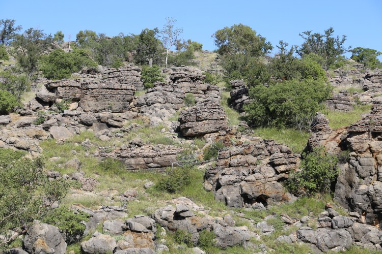
Cambrian limestone ‘pancakes’ outcrop (550 Mya) 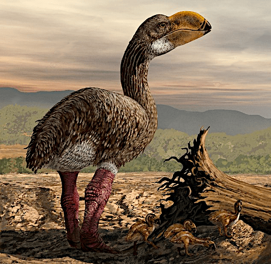
Dromornis stirtoni (from http://www.sciencephoto.com/media/77915/view). A 3+ m, 500+ kg magpie goose! 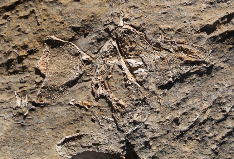
Dromornithid bones – honeycomb structure indicates a bird 
Dromornithid bones and polished stones in its crop
The 200+ Riversleigh locations represent four major faunal zones: Zone A – Late or Upper Oligocene, 28.4 to 23.03 Mya; Zone B – Early or Lower Miocene, 23.03 to 15.97 Mya; Zone C – Middle Miocene, 15.97 to 11.61 Mya; and Zone D – Late or Upper Miocene, 11.61 to 5.33 Mya (Wikipedia “Riversleigh”, 2022).
The fossils, which formed when the landscape was changing from rainforest to semiarid grassland community, are particularly well-preserved because they occur in uncompacted soft freshwater limestone. Many were in crevices and limestone caves that acted as pitfall traps and feeding spots for predators. Presumably these sites were periodically covered by mineral-rich waters. Fossils also formed in cave guano – a reason why the deposits are the world’s richest bat fossil site, with 35 species recorded.
The Lawn Hill Impact Structure A ring-shaped outcrop of structurally-disturbed limestone of about 18 km radius at Gum Hole Plain is possibly the remains of a meteorite strike during the Ordovician (ca. 472 ±8 Mya; Darlington et al 2016). The meteorite may have been associated with the breakup of an asteroid in the asteroid belt at ca. 470 Mya. Evidently at least 13 meteorite craters have been ascribed to fragments of the asteroid landing on Earth.

Evidence for an impact includes shatter cones within rocks, evidence of high-pressure shock metamorphism in some minerals (micro-diamonds and evidence of melting), and large upside-down blocks of limestone (Hutton and Withnall 2020). There was possibly up to 300 m of sedimentary rocks on top of the currently exposed limestone at the time of impact. The crater lacks a central cone probably because it was wet when the meteorite hit (water absorbs and dissipates some of the energy of the strike).


References and abbreviations
Archer M, Hand S, Godthelp H 1994 Riversleigh. Reed, NSW
Eberhard S 2003 Nowranie Caves and the Camooweal karst area, Queensland: hydrology, geomorphology and speleogenesis, with notes on aquatic biota. Helictite 38, 27-38
Hutton L, Withnall I 2020 Rocks and landscapes of northwest Queensland. Geological Society of Australia, Queensland Division
QPWS – Queensland Parks and Wildlife Service
Stevens NC 1984 Queensland field geology guide. Geological Society of Australia (Queensland Division). Page 112
TERN – Terrestrial Ecosystem and Research Network
UNESCO – United Nations Educational Scientific and Cultural Organization
Withnall IW, Cranfield LC 2013 Geological framework of Queensland. Queensland Minerals 2013, 13-31.
