A SOJOURN AT BLACKBRAES
In November 2021 I visited Blackbraes National Park, assisting Queensland Parks and Wildlife Service (QPWS) rangers Lea Ezzy and Becky Miller, and Central Queensland University Adjunct-Professor Simon Robson, in surveys of mammal diversity and park health. In what follows I provide information about the park and our activities.

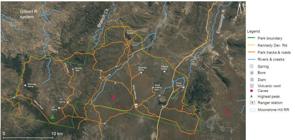
Blackbraes background: Gazetted in 1998, and managed by QPWS, Blackbraes 52,000 ha includes the former Blackbraes Pastoral Holding and the Moonstone Hill and Kennedy Road Gravel Resource Reserves. It lies on the Kennedy Developmental Road 170 km north of Hughenden, ca. 280 km west of Townsville, where it straddles two bioregions, Einasleigh Uplands and Gulf Plains, and three local government entities, Flinders, Etheridge and Charters Towers. Willmott (2009) provides a frustratingly minimal description of the geology!

The south-western Einasleigh Uplands section of the park includes basalt plains and granite hills that are principally covered with ironbark woodlands. On the plains, the most common trees are Eucalyptus crebra (narrow-leaved ironbark) E. orgadophila (mountain coolabah) and E. platyphylla (poplar gum). The plains are dotted with wetlands, swamps, dams and springs with associated water-birds and aquatic plants. On the granite hills the most common trees are E. crebra, E. shirleyi (silver-leaved ironbark) and Grevillea decora.
The larger Gulf Plains section of the park with its (marine derived?) sandstone ranges, plateaus and escarpments support tall eucalypt forest of Corymbia citriodora (lemon-scented gum), E. mediocris (inland white mahogany), E. crebra, Callitris intratropica (coast cypress) and the vulnerable Acacia ramiflora.
With the entire park higher than 850 m a.s.l., orographic rainfall contributes to the seasonal monsoonal water supply. In the Juntala Plateau, in the park’s south-west, an unnamed peak of 1,043 m is the highest point in the Gregory Range (part of the Great Dividing Range). Although inland, the park also occasionally receives rain from cyclones that cross the eastern and gulf coasts.
Roughly forty tributaries drain Blackbraes north into the Gilbert River system including the Copperfield, Einasleigh, Langdon, Little, Percy, Robertson and Styx (Vanderduys et al 2012). Water trapped in basalt and sandstone strata feeds springs, creeks and small swamps that dot the park.
Animals and plants: With the exception of invertebrates, species lists are here, at birds and at
Caves and bats: Dolmens containing caves (marked red on the map) are known in basalt flows near a volcanic vent a few km from Blackbraes ranger station. A 1970’s report by the Queensland University Speleological Society (Grimes 1978), demonstrated that bats were present. It was suggested that the caves may host a maternity colony. Reproductions of Grimes’ sketches are below.
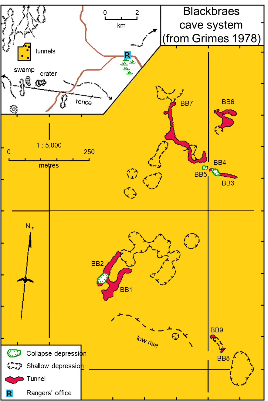
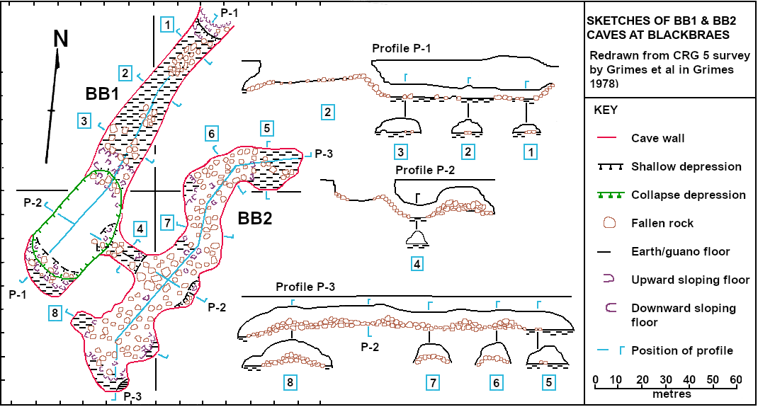
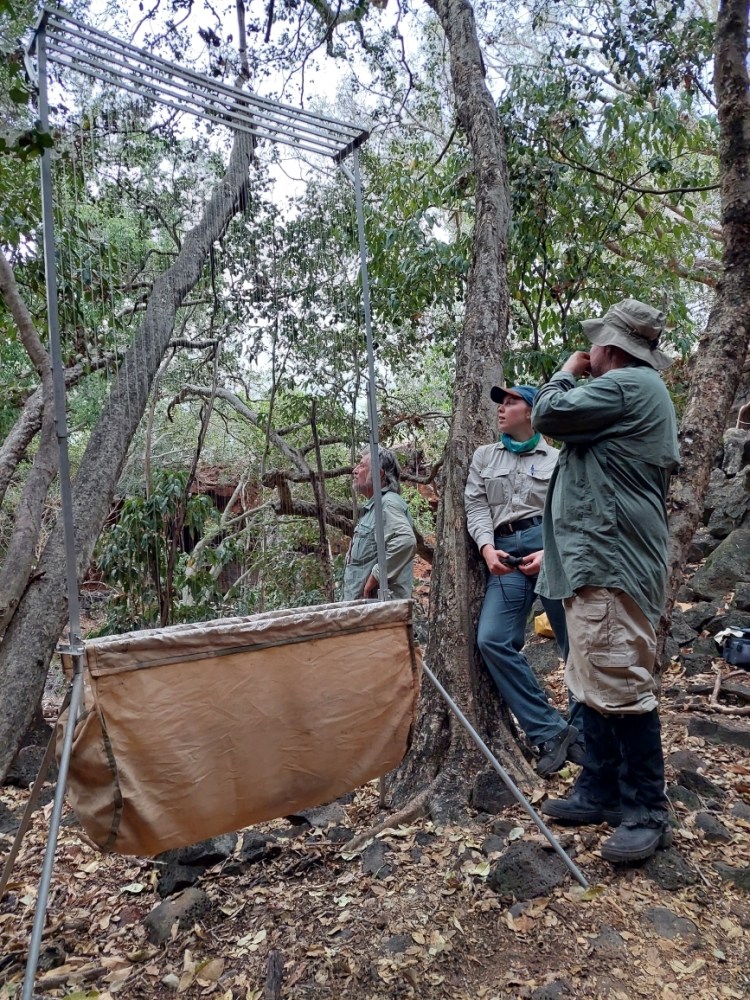
Simon and I aimed to identify any bats, to estimate numbers and to ascertain whether a maternity colony was present. Carrying harp traps and backpacks, we intrepid explorers made heavy work of the 2.1 km trek to a dolmen (sink-hole) into which caves BB1 and BB2 opened.
At an opening to cave BB1, we set up a 5-rank harp trap and an Anabat detector. When dusk fell, literally thousands of bats (overwhelmingly Minopterus orianae orianae, northern bent-wing bat) swarmed from the cave and the trap caught 30 bats in a couple of minutes before we lowered it.
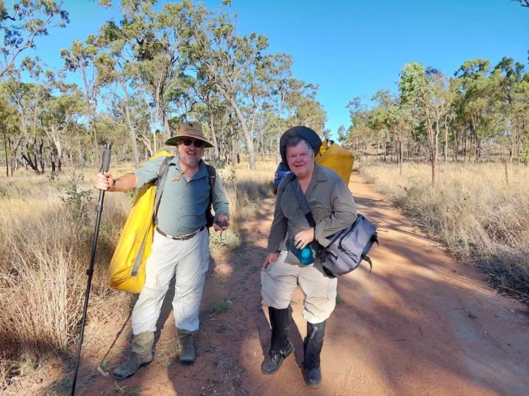
All smiles with traps and backpacks before the trek. Photo by Lea Ezzy. 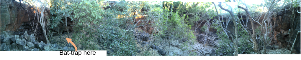
Composite picture, maternity cave (BB1) to the left. Arrow indicates site of bat-trap. Other cave and overhang not examined shown in next photos 
Opening to southern overhang 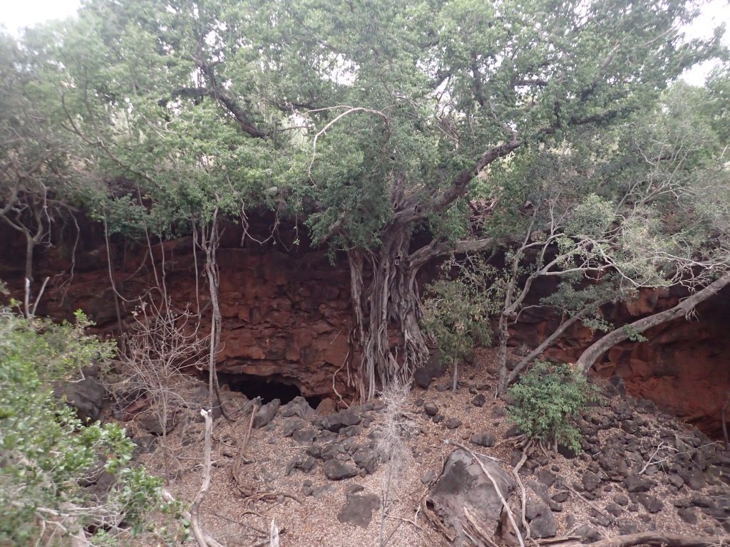
Opening to cave BB2 
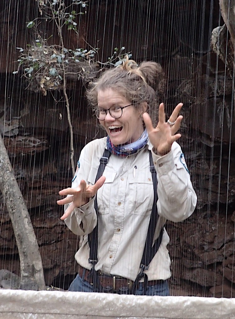
Bent-wing bats in the harp trap outside cave BB1. Photo by Lea Ezzy. 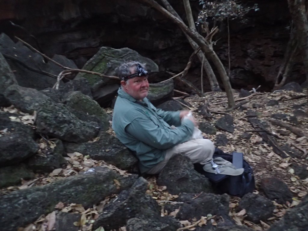
‘Dalek’ Robson overwhelmed by a trek and bat overdose at BB1! 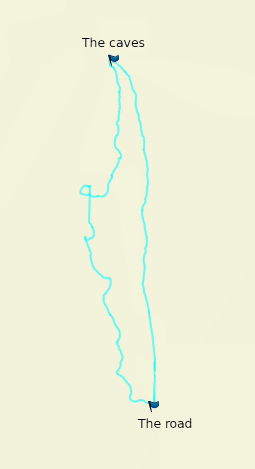
Honestly, the treck back at night was alcohol-free! … and we had two GPS’ 
The ‘boys’ after the trek! Photo by Lea Ezzy.
Evidence for a maternity colony is persuasive – of the bats we examined, 80 % were female, all pregnant. The remainder were juvenile males. The walk back to the car through the basalt-strewn bush in the dark before the moon arose was a tough one. Repeatedly disoriented, it took us 1.5 h to traverse the 2.1 km (see track in the slide-show below). We were knackered at the end of it, but happy bunnies!
Two days later we returned to the caves, but by buggy. Slow but less stress, particularly the return trip after dark (for us, not the driver)!


From his bat detectors, Simon identified the calls of Chaerephon jobensis (northern free-tail bat), Miniopterus australis oceanensis (eastern bent-winged bat), M. orianae (northen bent-winged bat), Rhinolophus megaphyllus (eastern horseshoe bat), Ozimops lumsdenae (Lumsden’s free-tail bat), O. ridei (Ride’s free-tail bat), Saccolaimus flaviventris (yellow-bellied sheathtail bat), Scotorepens balstoni (inland broad-nosed bat), Taphozous troughton (Troughton’s sheathtail bat) and a ‘species group’ potentially including Scotorepens greyii (little broad-nosed bat), S. sanborn (northern broad-nosed bat) and/or Setirostris eleryi (hairy-nosed free-tail bat) (Robson and Ezzy 2021).
Spotlighting: We undertook a 13 km spotlighting transect as part of a survey of the park for creatures arboreal. In addition to spotting sugar gliders, squirrel gliders, brushtail possums, tawny frogmouths and owls, 80 greater gliders were seen, supporting the proposal that the park has one of the highest densities of greater gliders in Australia!
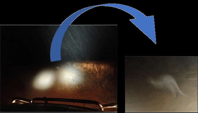
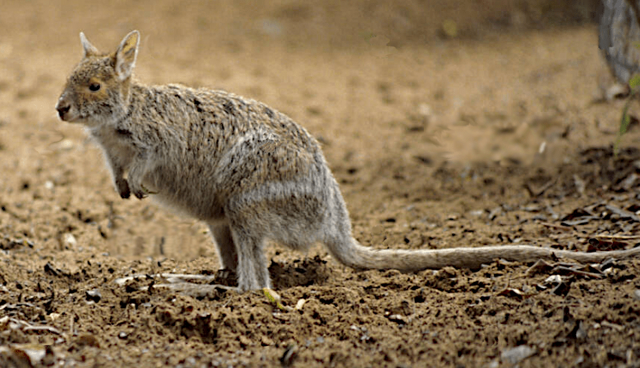
Photograph of the year! Professor Robson intends making his fortune by submitting a magnificent photo to National Geographic! Originally, he claimed it was of a Thylacine, or possibly a night parrot, but settled on a spectacled hare-wallaby (Lagorchestes conspicillatus). The second slide below is a more modest photo taken by somebody else of lesser skill.
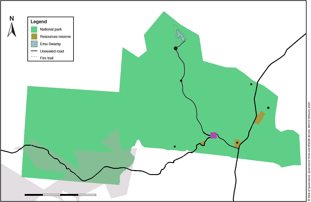
The Moonstone Hill Resources Reserve: The reserve is a volcanic vent of red-brown scoria (lava with a high proportion of gas bubbles). The scoria and eroded soils contain moonstones, crystals that appear silvery-white to blue when turned in certain directions. The moonstones are feldspar crystals that form within gas cavities in the lava. Unusually, these moonstones are anorthoclase feldspar in which sodium is in excess of potassium.
Most crystals are colourless and transparent, but some are translucent to opaque with the silvery-white to bluish adularescence (A great word! It means an optical effect supposedly similar to the shimmering appearance of the moon on a cloudless evening!) characteristic of moonstones. We didn’t fossick but saw many small crystals strewn across the landscape.
Emu Swamp: Emu swamp was a dam in the old Blackbraes Pastoral Holding. Originally slated for draining, it was kept intact after the formation of the National Park. It is now a peaceful extensive permanent lagoon and swamp home to many waterfowl, including pelicans and black swans.

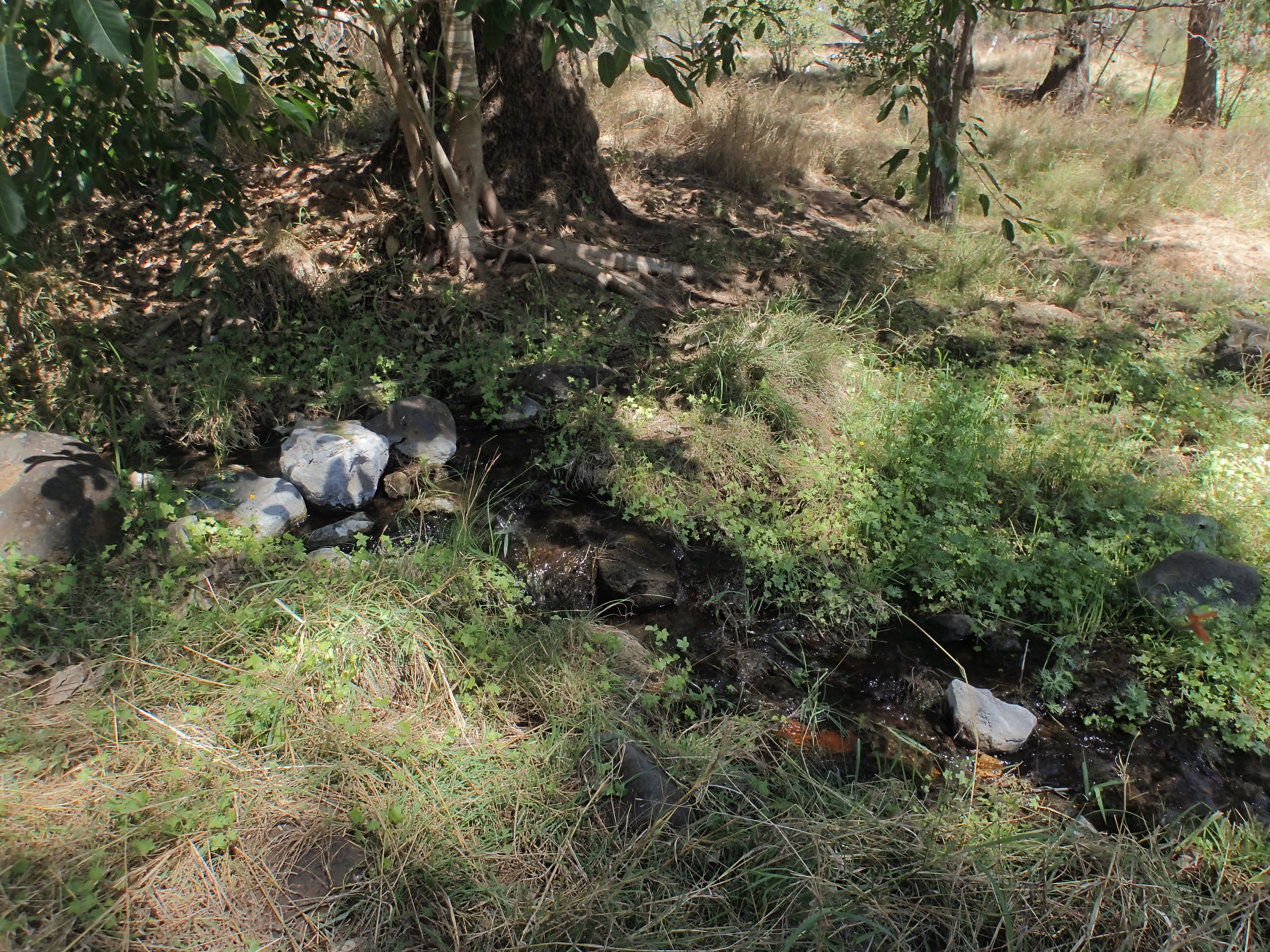
Picnic Springs: These springs emerge from the basalt and feed the headwaters of the Einasleigh River. A lovely spot.

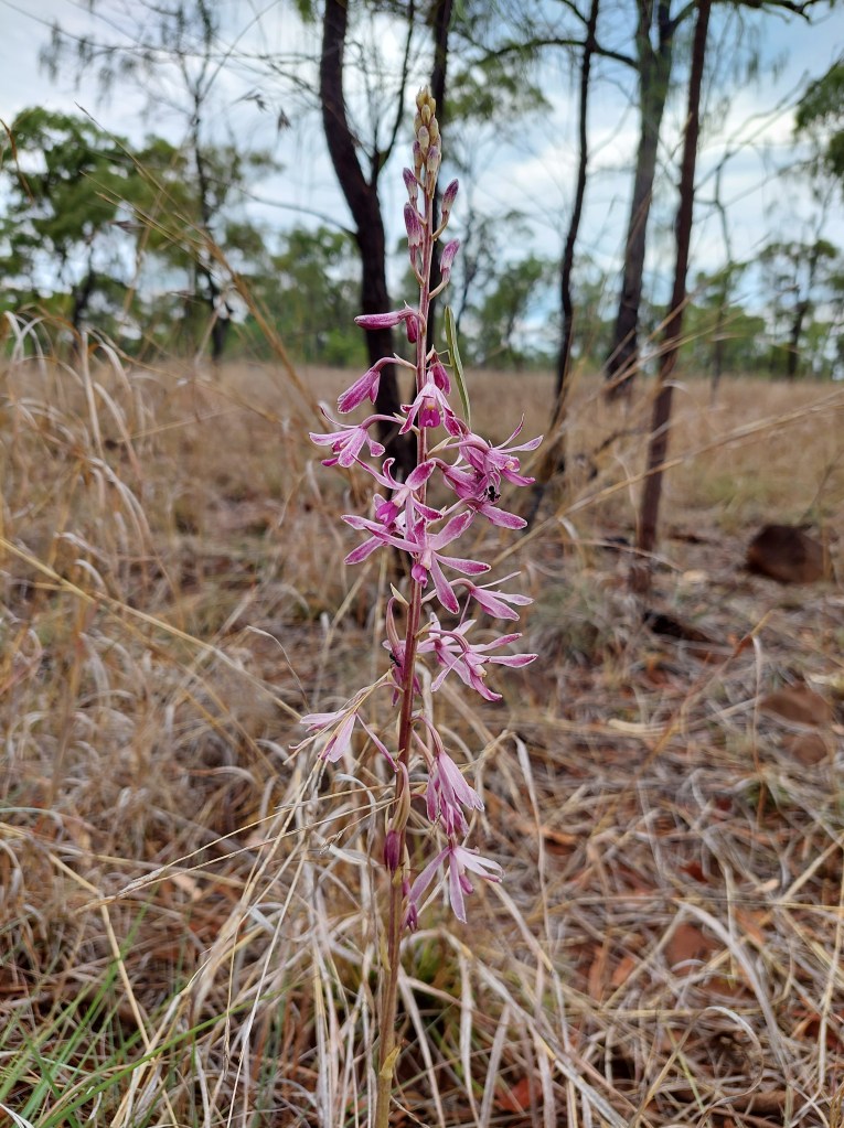
Plants: A beautiful flower spike is all you see of the leafless Dipodium elegantulum, the elegant hyacinth orchid. This orchid does not have leaves and so does not photosynthesise. An obligate mycoheterotroph, it obtains carbon from a fungus that parasitises myrtaceous species.
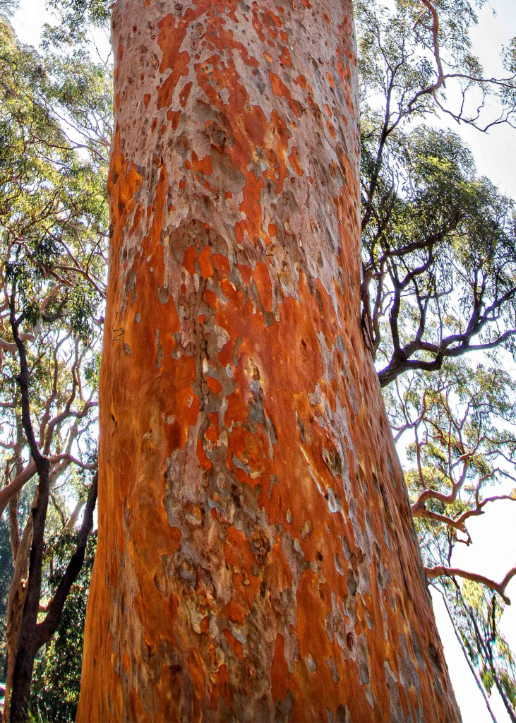
Log Spring features a population of Angophora costata subsp. costata (Sydney blue gum) with its beautiful orange bark. The species commonly grows in coastal NSW and southern Queensland but disjunct populations are at White Mountains NP and at Blackbraes.
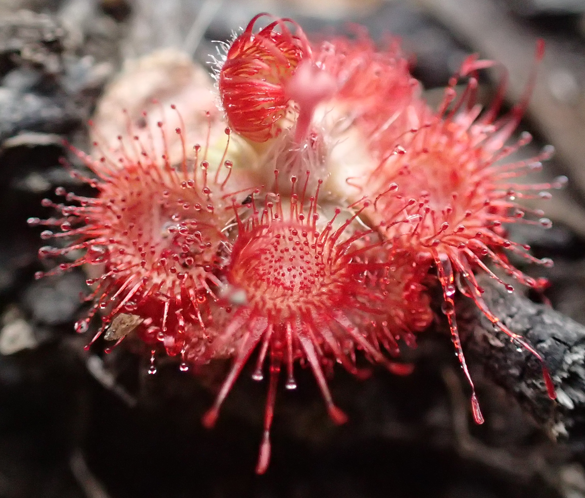
Amongst the grasses and sedges at Tin Spring was a stunning small Drosera, 1-2 cm in diameter. It had rained on the day we visited and the air was heady with the lemon-myrtle aroma of Corymbia citriodora (lemon-scented gum). The landscape was tinted by the salmon-pink bark of C. citriodora and the flaky earthy-orange bark of Corymbia peltata (yellowjacket gum), a Queensland endemic.
Unusually for properties in Australia’s north, there is no buffel grass (Cenchrus ciliaris) on Blackbraes.
References
Grimes KG 1978 The Blackbraes lava tunnels, North Queensland. Down Under (Newsletter of the University of Queensland Speleological Society) 17 (1), 7-16
Robson S, Ezzy L 2021 Blackbraes National Park bat survey – November 2020 and November 2021. Report
Vanderduys EP, Kutt AS, Kemp JE 2012 Upland savannas: the vertebrate fauna of a largely unknown but significant habitat in north-eastern Queensland. Australian Zoologist 36 (1), 59-74 DOI:10.7882/AZ.2012.007
Willmott W 2009 Rocks and landscapes of the national parks of North Queensland. Geological Society of Australia. http://www.qld.gsa.org.au
